You are here: Home > Network List > KN - Kyrgyz Seismic Telemetry Network Stations List
> Station TKM2 KN.TKM2 > Earthquake Result Viewer
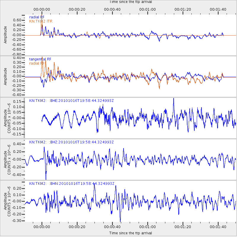
TKM2 KN.TKM2 - Earthquake Result Viewer
*The percent match for this event was below the threshold and hence no stack was calculated.
| Earthquake location: |
Nicobar Islands, India Region |
| Earthquake latitude/longitude: |
6.6/94.3 |
| Earthquake time(UTC): |
2010/10/16 (289) 19:51:51 GMT |
| Earthquake Depth: |
94 km |
| Earthquake Magnitude: |
5.7 MB, 5.3 MW, 5.3 MW |
| Earthquake Catalog/Contributor: |
WHDF/NEIC |
|
| Network: |
KN Kyrgyz Seismic Telemetry Network |
| Station: |
TKM2 KN.TKM2 |
| Lat/Lon: |
42.92 N/75.60 E |
| Elevation: |
2020 m |
|
| Distance: |
39.7 deg |
| Az: |
338.336 deg |
| Baz: |
150.051 deg |
| Ray Param: |
$rayparam |
*The percent match for this event was below the threshold and hence was not used in the summary stack. |
|
| Radial Match: |
60.92374 % |
| Radial Bump: |
400 |
| Transverse Match: |
54.02007 % |
| Transverse Bump: |
400 |
| SOD ConfigId: |
339645 |
| Insert Time: |
2011-02-17 08:09:41.942 +0000 |
| GWidth: |
2.5 |
| Max Bumps: |
400 |
| Tol: |
0.001 |
|
Signal To Noise
| Channel | StoN | STA | LTA |
| KN:TKM2: :BHZ:20101016T19:58:44.324993Z | 2.2565553 | 1.6737175E-7 | 7.4171346E-8 |
| KN:TKM2: :BHN:20101016T19:58:44.324993Z | 1.4320071 | 8.1898044E-8 | 5.719109E-8 |
| KN:TKM2: :BHE:20101016T19:58:44.324993Z | 1.8286246 | 7.3878105E-8 | 4.0400913E-8 |
| Arrivals |
| Ps | |
| PpPs | |
| PsPs/PpSs | |


