KUM Kulim - Earthquake Result Viewer
Earthquake location: Tonga Islands
Earthquake latitude/longitude: -20.4/-173.8
Earthquake time(UTC): 2010/10/16 (289) 20:08:30 GMT
Earthquake Depth: 8.0 km
Earthquake Magnitude: 6.1 MB, 5.9 MS, 5.9 MW, 5.8 MW
Earthquake Catalog/Contributor: WHDF/NEIC
Network: MY Malaysian National Seismic Network
Station: KUM Kulim
Lat/Lon: 5.29 N/100.65 E
Elevation: 74 m
Distance: 87.6 deg
Az: 276.492 deg
Baz: 110.63 deg
Ray Param: 0.043194693
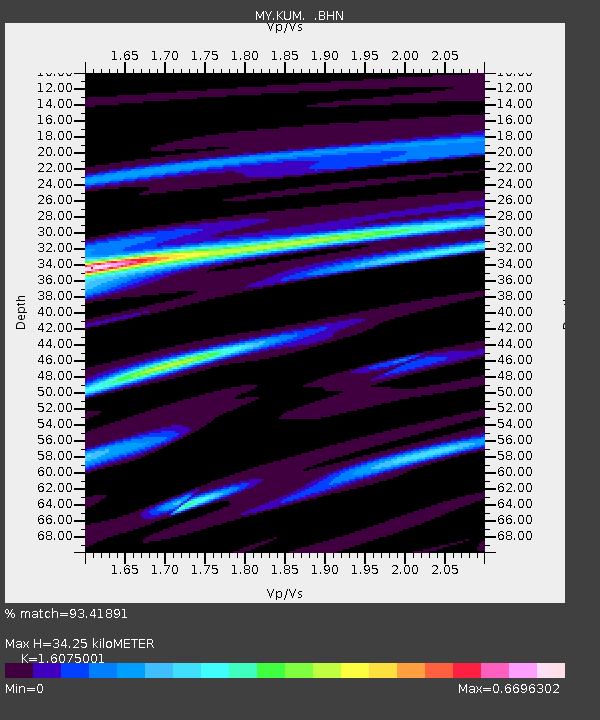
Estimated Moho Depth: 34.25 km
Estimated Crust Vp/Vs: 1.61
Assumed Crust Vp: 6.468 km/s
Estimated Crust Vs: 4.023 km/s
Estimated Crust Poisson's Ratio: 0.18
Radial Match: 93.41891 %
Radial Bump: 330
Transverse Match: 82.978676 %
Transverse Bump: 400
SOD ConfigId: 339645
Insert Time: 2011-02-17 08:22:42.585 +0000
GWidth: 2.5
Max Bumps: 400
Tol: 0.001

Signal To Noise

ChannelStoNSTALTA
MY:KUM: :BHZ:20101016T20:20:47.270012Z9.0586037.554944E-78.340076E-8
MY:KUM: :BHN:20101016T20:20:47.270012Z0.466622866.455772E-81.3835096E-7
MY:KUM: :BHE:20101016T20:20:47.270012Z4.9990473.457262E-76.915842E-8
Arrivals
Ps3.3 SECOND
PpPs13 SECOND
PsPs/PpSs17 SECOND