You are here: Home > Network List > TA - USArray Transportable Network (new EarthScope stations) Stations List
> Station M04C Macdoel, CA, USA > Earthquake Result Viewer
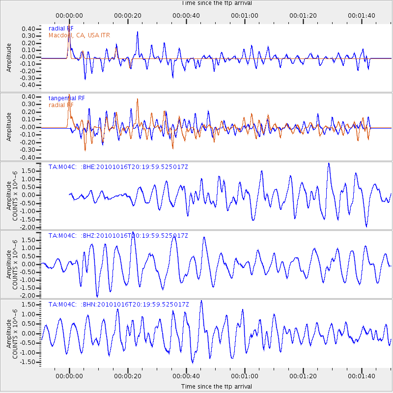
M04C Macdoel, CA, USA - Earthquake Result Viewer
*The percent match for this event was below the threshold and hence no stack was calculated.
| Earthquake location: |
Tonga Islands |
| Earthquake latitude/longitude: |
-20.4/-173.8 |
| Earthquake time(UTC): |
2010/10/16 (289) 20:08:30 GMT |
| Earthquake Depth: |
8.0 km |
| Earthquake Magnitude: |
6.1 MB, 5.9 MS, 5.9 MW, 5.8 MW |
| Earthquake Catalog/Contributor: |
WHDF/NEIC |
|
| Network: |
TA USArray Transportable Network (new EarthScope stations) |
| Station: |
M04C Macdoel, CA, USA |
| Lat/Lon: |
41.78 N/121.84 W |
| Elevation: |
1391 m |
|
| Distance: |
78.4 deg |
| Az: |
36.996 deg |
| Baz: |
228.998 deg |
| Ray Param: |
$rayparam |
*The percent match for this event was below the threshold and hence was not used in the summary stack. |
|
| Radial Match: |
72.65716 % |
| Radial Bump: |
400 |
| Transverse Match: |
54.315815 % |
| Transverse Bump: |
400 |
| SOD ConfigId: |
339645 |
| Insert Time: |
2011-02-17 08:23:48.314 +0000 |
| GWidth: |
2.5 |
| Max Bumps: |
400 |
| Tol: |
0.001 |
|
Signal To Noise
| Channel | StoN | STA | LTA |
| TA:M04C: :BHZ:20101016T20:19:59.525017Z | 2.380521 | 4.847229E-7 | 2.036205E-7 |
| TA:M04C: :BHN:20101016T20:19:59.525017Z | 1.2158111 | 6.0312817E-7 | 4.960706E-7 |
| TA:M04C: :BHE:20101016T20:19:59.525017Z | 2.6124 | 5.7816413E-7 | 2.213153E-7 |
| Arrivals |
| Ps | |
| PpPs | |
| PsPs/PpSs | |


