You are here: Home > Network List > TA - USArray Transportable Network (new EarthScope stations) Stations List
> Station 431A Sonora, TX, USA > Earthquake Result Viewer
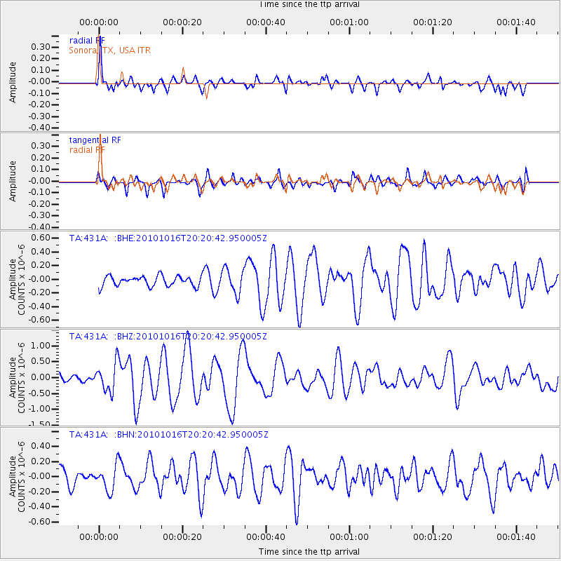
431A Sonora, TX, USA - Earthquake Result Viewer
*The percent match for this event was below the threshold and hence no stack was calculated.
| Earthquake location: |
Tonga Islands |
| Earthquake latitude/longitude: |
-20.4/-173.8 |
| Earthquake time(UTC): |
2010/10/16 (289) 20:08:30 GMT |
| Earthquake Depth: |
8.0 km |
| Earthquake Magnitude: |
6.1 MB, 5.9 MS, 5.9 MW, 5.8 MW |
| Earthquake Catalog/Contributor: |
WHDF/NEIC |
|
| Network: |
TA USArray Transportable Network (new EarthScope stations) |
| Station: |
431A Sonora, TX, USA |
| Lat/Lon: |
30.68 N/100.61 W |
| Elevation: |
700 m |
|
| Distance: |
86.7 deg |
| Az: |
55.715 deg |
| Baz: |
244.101 deg |
| Ray Param: |
$rayparam |
*The percent match for this event was below the threshold and hence was not used in the summary stack. |
|
| Radial Match: |
77.52741 % |
| Radial Bump: |
400 |
| Transverse Match: |
66.56735 % |
| Transverse Bump: |
400 |
| SOD ConfigId: |
339645 |
| Insert Time: |
2011-02-17 08:26:48.825 +0000 |
| GWidth: |
2.5 |
| Max Bumps: |
400 |
| Tol: |
0.001 |
|
Signal To Noise
| Channel | StoN | STA | LTA |
| TA:431A: :BHZ:20101016T20:20:42.950005Z | 3.5333803 | 4.6057693E-7 | 1.3035023E-7 |
| TA:431A: :BHN:20101016T20:20:42.950005Z | 1.3842229 | 1.742315E-7 | 1.2586955E-7 |
| TA:431A: :BHE:20101016T20:20:42.950005Z | 2.4266036 | 1.7783799E-7 | 7.328679E-8 |
| Arrivals |
| Ps | |
| PpPs | |
| PsPs/PpSs | |


