You are here: Home > Network List > TA - USArray Transportable Network (new EarthScope stations) Stations List
> Station 131A Roby, TX, USA > Earthquake Result Viewer
131A Roby, TX, USA - Earthquake Result Viewer
*The percent match for this event was below the threshold and hence no stack was calculated.
| Earthquake location: |
Tonga Islands |
| Earthquake latitude/longitude: |
-20.4/-173.8 |
| Earthquake time(UTC): |
2010/10/16 (289) 20:08:30 GMT |
| Earthquake Depth: |
8.0 km |
| Earthquake Magnitude: |
6.1 MB, 5.9 MS, 5.9 MW, 5.8 MW |
| Earthquake Catalog/Contributor: |
WHDF/NEIC |
|
| Network: |
TA USArray Transportable Network (new EarthScope stations) |
| Station: |
131A Roby, TX, USA |
| Lat/Lon: |
32.67 N/100.39 W |
| Elevation: |
622 m |
|
| Distance: |
87.8 deg |
| Az: |
54.008 deg |
| Baz: |
244.134 deg |
| Ray Param: |
$rayparam |
*The percent match for this event was below the threshold and hence was not used in the summary stack. |
|
| Radial Match: |
78.74723 % |
| Radial Bump: |
233 |
| Transverse Match: |
70.576126 % |
| Transverse Bump: |
325 |
| SOD ConfigId: |
339645 |
| Insert Time: |
2011-02-17 08:28:16.936 +0000 |
| GWidth: |
2.5 |
| Max Bumps: |
400 |
| Tol: |
0.001 |
|
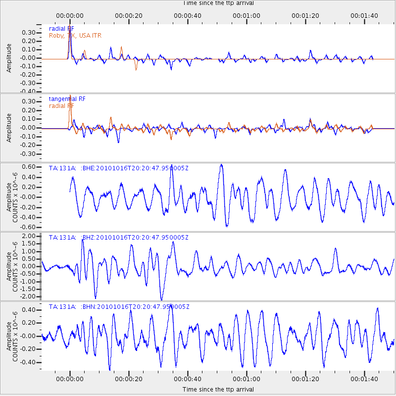
Signal To Noise
| Channel | StoN | STA | LTA |
| TA:131A: :BHZ:20101016T20:20:47.950005Z | 3.9889657 | 7.1447676E-7 | 1.7911329E-7 |
| TA:131A: :BHN:20101016T20:20:47.950005Z | 0.68335897 | 1.1150855E-7 | 1.6317712E-7 |
| TA:131A: :BHE:20101016T20:20:47.950005Z | 1.6634469 | 2.915497E-7 | 1.7526841E-7 |
| Arrivals |
| Ps | |
| PpPs | |
| PsPs/PpSs | |


