You are here: Home > Network List > TA - USArray Transportable Network (new EarthScope stations) Stations List
> Station Y31A Rekieta Farm, Paducah, TX, USA > Earthquake Result Viewer
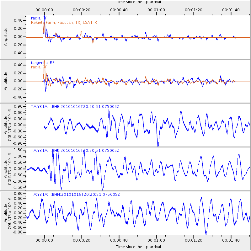
Y31A Rekieta Farm, Paducah, TX, USA - Earthquake Result Viewer
*The percent match for this event was below the threshold and hence no stack was calculated.
| Earthquake location: |
Tonga Islands |
| Earthquake latitude/longitude: |
-20.4/-173.8 |
| Earthquake time(UTC): |
2010/10/16 (289) 20:08:30 GMT |
| Earthquake Depth: |
8.0 km |
| Earthquake Magnitude: |
6.1 MB, 5.9 MS, 5.9 MW, 5.8 MW |
| Earthquake Catalog/Contributor: |
WHDF/NEIC |
|
| Network: |
TA USArray Transportable Network (new EarthScope stations) |
| Station: |
Y31A Rekieta Farm, Paducah, TX, USA |
| Lat/Lon: |
33.96 N/100.26 W |
| Elevation: |
530 m |
|
| Distance: |
88.4 deg |
| Az: |
52.897 deg |
| Baz: |
244.167 deg |
| Ray Param: |
$rayparam |
*The percent match for this event was below the threshold and hence was not used in the summary stack. |
|
| Radial Match: |
75.52816 % |
| Radial Bump: |
339 |
| Transverse Match: |
50.53138 % |
| Transverse Bump: |
340 |
| SOD ConfigId: |
339645 |
| Insert Time: |
2011-02-17 08:28:22.086 +0000 |
| GWidth: |
2.5 |
| Max Bumps: |
400 |
| Tol: |
0.001 |
|
Signal To Noise
| Channel | StoN | STA | LTA |
| TA:Y31A: :BHZ:20101016T20:20:51.075005Z | 3.7834806 | 5.341836E-7 | 1.4118841E-7 |
| TA:Y31A: :BHN:20101016T20:20:51.075005Z | 1.0346069 | 2.8130214E-7 | 2.7189276E-7 |
| TA:Y31A: :BHE:20101016T20:20:51.075005Z | 1.8836738 | 3.371204E-7 | 1.7896964E-7 |
| Arrivals |
| Ps | |
| PpPs | |
| PsPs/PpSs | |


