You are here: Home > Network List > TA - USArray Transportable Network (new EarthScope stations) Stations List
> Station E29A Napoleon, ND, USA > Earthquake Result Viewer
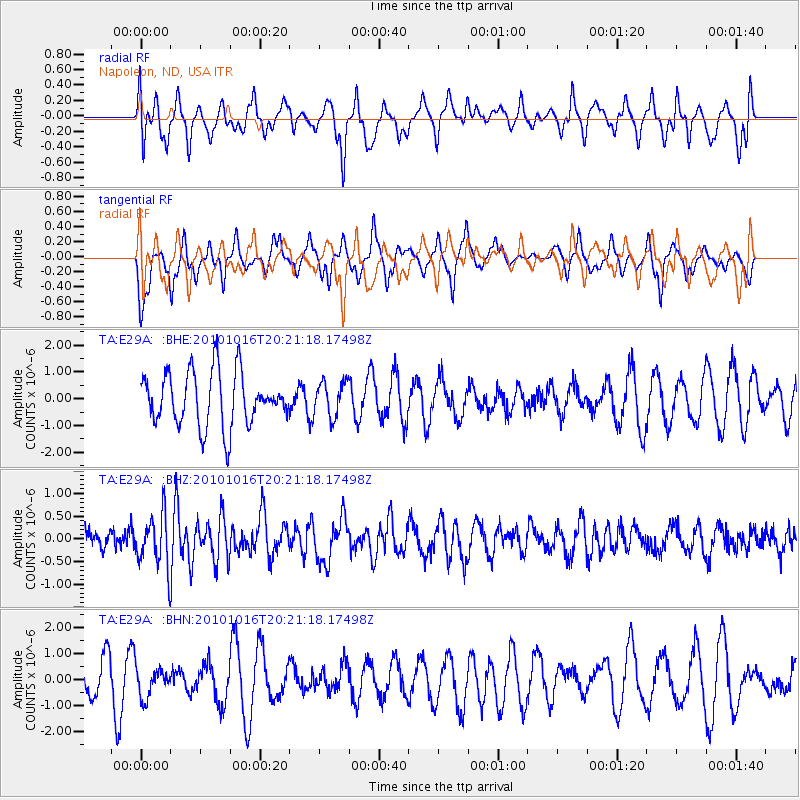
E29A Napoleon, ND, USA - Earthquake Result Viewer
*The percent match for this event was below the threshold and hence no stack was calculated.
| Earthquake location: |
Tonga Islands |
| Earthquake latitude/longitude: |
-20.4/-173.8 |
| Earthquake time(UTC): |
2010/10/16 (289) 20:08:30 GMT |
| Earthquake Depth: |
8.0 km |
| Earthquake Magnitude: |
6.1 MB, 5.9 MS, 5.9 MW, 5.8 MW |
| Earthquake Catalog/Contributor: |
WHDF/NEIC |
|
| Network: |
TA USArray Transportable Network (new EarthScope stations) |
| Station: |
E29A Napoleon, ND, USA |
| Lat/Lon: |
46.57 N/99.64 W |
| Elevation: |
628 m |
|
| Distance: |
94.3 deg |
| Az: |
41.739 deg |
| Baz: |
244.834 deg |
| Ray Param: |
$rayparam |
*The percent match for this event was below the threshold and hence was not used in the summary stack. |
|
| Radial Match: |
70.525536 % |
| Radial Bump: |
400 |
| Transverse Match: |
49.832584 % |
| Transverse Bump: |
297 |
| SOD ConfigId: |
339645 |
| Insert Time: |
2011-02-17 08:33:14.295 +0000 |
| GWidth: |
2.5 |
| Max Bumps: |
400 |
| Tol: |
0.001 |
|
Signal To Noise
| Channel | StoN | STA | LTA |
| TA:E29A: :BHZ:20101016T20:21:18.17498Z | 2.3103213 | 5.7415707E-7 | 2.4851826E-7 |
| TA:E29A: :BHN:20101016T20:21:18.17498Z | 0.8671606 | 5.4885265E-7 | 6.3293083E-7 |
| TA:E29A: :BHE:20101016T20:21:18.17498Z | 0.648406 | 6.469798E-7 | 9.978004E-7 |
| Arrivals |
| Ps | |
| PpPs | |
| PsPs/PpSs | |


