You are here: Home > Network List > TA - USArray Transportable Network (new EarthScope stations) Stations List
> Station E30A Jud, ND, USA > Earthquake Result Viewer
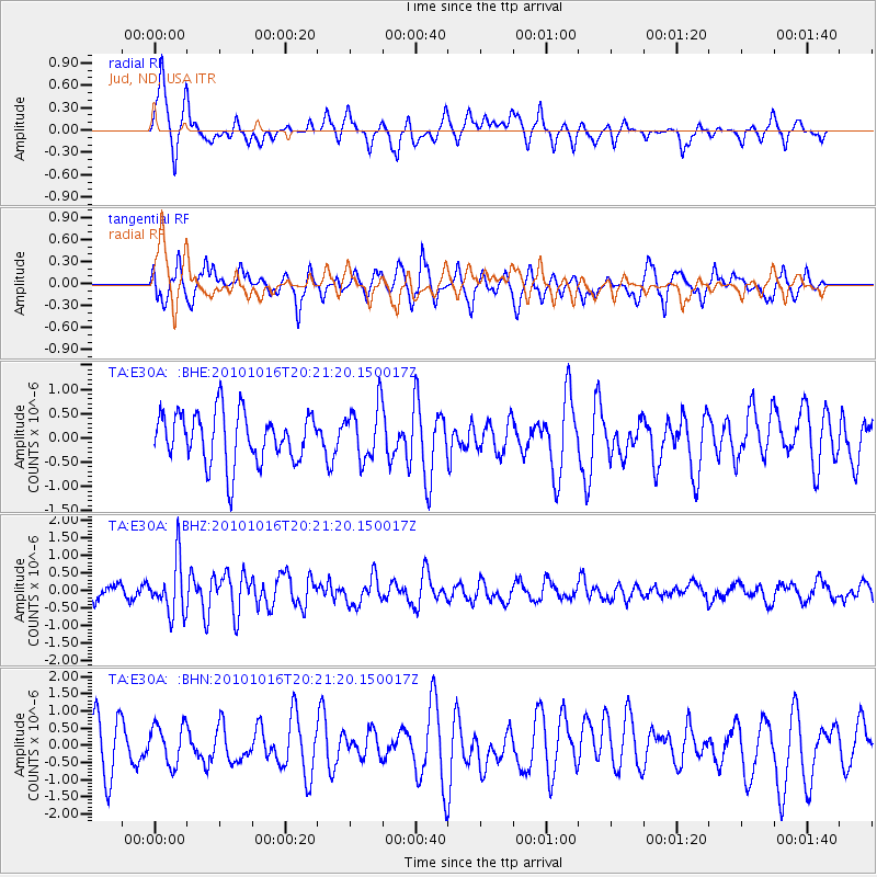
E30A Jud, ND, USA - Earthquake Result Viewer
*The percent match for this event was below the threshold and hence no stack was calculated.
| Earthquake location: |
Tonga Islands |
| Earthquake latitude/longitude: |
-20.4/-173.8 |
| Earthquake time(UTC): |
2010/10/16 (289) 20:08:30 GMT |
| Earthquake Depth: |
8.0 km |
| Earthquake Magnitude: |
6.1 MB, 5.9 MS, 5.9 MW, 5.8 MW |
| Earthquake Catalog/Contributor: |
WHDF/NEIC |
|
| Network: |
TA USArray Transportable Network (new EarthScope stations) |
| Station: |
E30A Jud, ND, USA |
| Lat/Lon: |
46.50 N/98.91 W |
| Elevation: |
544 m |
|
| Distance: |
94.7 deg |
| Az: |
42.013 deg |
| Baz: |
245.342 deg |
| Ray Param: |
$rayparam |
*The percent match for this event was below the threshold and hence was not used in the summary stack. |
|
| Radial Match: |
50.736164 % |
| Radial Bump: |
351 |
| Transverse Match: |
62.59401 % |
| Transverse Bump: |
389 |
| SOD ConfigId: |
339645 |
| Insert Time: |
2011-02-17 08:33:29.841 +0000 |
| GWidth: |
2.5 |
| Max Bumps: |
400 |
| Tol: |
0.001 |
|
Signal To Noise
| Channel | StoN | STA | LTA |
| TA:E30A: :BHZ:20101016T20:21:20.150017Z | 3.7927938 | 7.5123387E-7 | 1.9806873E-7 |
| TA:E30A: :BHN:20101016T20:21:20.150017Z | 0.52910995 | 5.656331E-7 | 1.0690275E-6 |
| TA:E30A: :BHE:20101016T20:21:20.150017Z | 1.069126 | 5.522099E-7 | 5.165059E-7 |
| Arrivals |
| Ps | |
| PpPs | |
| PsPs/PpSs | |


