You are here: Home > Network List > TA - USArray Transportable Network (new EarthScope stations) Stations List
> Station B29A Wagenman Farm, Cando, ND, USA > Earthquake Result Viewer
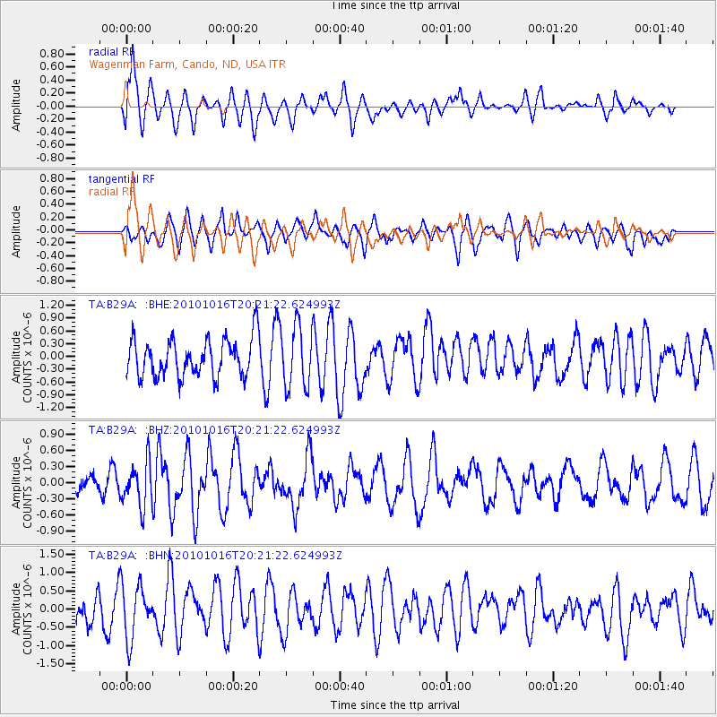
B29A Wagenman Farm, Cando, ND, USA - Earthquake Result Viewer
*The percent match for this event was below the threshold and hence no stack was calculated.
| Earthquake location: |
Tonga Islands |
| Earthquake latitude/longitude: |
-20.4/-173.8 |
| Earthquake time(UTC): |
2010/10/16 (289) 20:08:30 GMT |
| Earthquake Depth: |
8.0 km |
| Earthquake Magnitude: |
6.1 MB, 5.9 MS, 5.9 MW, 5.8 MW |
| Earthquake Catalog/Contributor: |
WHDF/NEIC |
|
| Network: |
TA USArray Transportable Network (new EarthScope stations) |
| Station: |
B29A Wagenman Farm, Cando, ND, USA |
| Lat/Lon: |
48.46 N/99.35 W |
| Elevation: |
460 m |
|
| Distance: |
95.3 deg |
| Az: |
40.096 deg |
| Baz: |
245.183 deg |
| Ray Param: |
$rayparam |
*The percent match for this event was below the threshold and hence was not used in the summary stack. |
|
| Radial Match: |
63.5398 % |
| Radial Bump: |
379 |
| Transverse Match: |
47.73965 % |
| Transverse Bump: |
400 |
| SOD ConfigId: |
339645 |
| Insert Time: |
2011-02-17 08:33:39.978 +0000 |
| GWidth: |
2.5 |
| Max Bumps: |
400 |
| Tol: |
0.001 |
|
Signal To Noise
| Channel | StoN | STA | LTA |
| TA:B29A: :BHZ:20101016T20:21:22.624993Z | 2.2314405 | 4.1590658E-7 | 1.863848E-7 |
| TA:B29A: :BHN:20101016T20:21:22.624993Z | 1.2291825 | 7.146072E-7 | 5.813679E-7 |
| TA:B29A: :BHE:20101016T20:21:22.624993Z | 1.6043764 | 7.129584E-7 | 4.4438346E-7 |
| Arrivals |
| Ps | |
| PpPs | |
| PsPs/PpSs | |


