You are here: Home > Network List > TA - USArray Transportable Network (new EarthScope stations) Stations List
> Station I29A Vivian, Onida, SD, USA > Earthquake Result Viewer
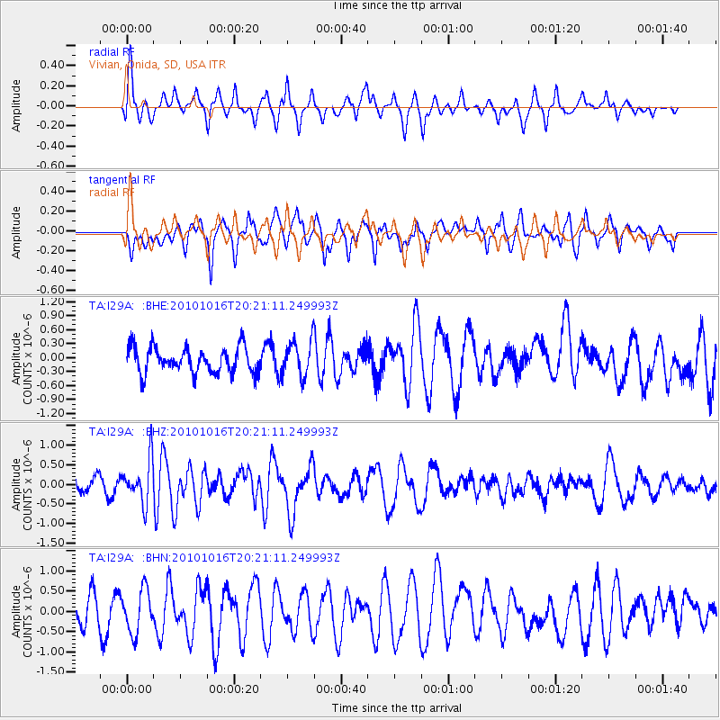
I29A Vivian, Onida, SD, USA - Earthquake Result Viewer
*The percent match for this event was below the threshold and hence no stack was calculated.
| Earthquake location: |
Tonga Islands |
| Earthquake latitude/longitude: |
-20.4/-173.8 |
| Earthquake time(UTC): |
2010/10/16 (289) 20:08:30 GMT |
| Earthquake Depth: |
8.0 km |
| Earthquake Magnitude: |
6.1 MB, 5.9 MS, 5.9 MW, 5.8 MW |
| Earthquake Catalog/Contributor: |
WHDF/NEIC |
|
| Network: |
TA USArray Transportable Network (new EarthScope stations) |
| Station: |
I29A Vivian, Onida, SD, USA |
| Lat/Lon: |
44.02 N/100.30 W |
| Elevation: |
592 m |
|
| Distance: |
92.8 deg |
| Az: |
43.841 deg |
| Baz: |
244.235 deg |
| Ray Param: |
$rayparam |
*The percent match for this event was below the threshold and hence was not used in the summary stack. |
|
| Radial Match: |
58.119358 % |
| Radial Bump: |
400 |
| Transverse Match: |
62.345463 % |
| Transverse Bump: |
400 |
| SOD ConfigId: |
339645 |
| Insert Time: |
2011-02-17 08:34:33.754 +0000 |
| GWidth: |
2.5 |
| Max Bumps: |
400 |
| Tol: |
0.001 |
|
Signal To Noise
| Channel | StoN | STA | LTA |
| TA:I29A: :BHZ:20101016T20:21:11.249993Z | 4.417379 | 5.521859E-7 | 1.2500307E-7 |
| TA:I29A: :BHN:20101016T20:21:11.249993Z | 2.0620487 | 5.3537195E-7 | 2.596311E-7 |
| TA:I29A: :BHE:20101016T20:21:11.249993Z | 1.4169574 | 3.8789273E-7 | 2.7375043E-7 |
| Arrivals |
| Ps | |
| PpPs | |
| PsPs/PpSs | |


