You are here: Home > Network List > TA - USArray Transportable Network (new EarthScope stations) Stations List
> Station J05D Fort Rock, OR, USA > Earthquake Result Viewer
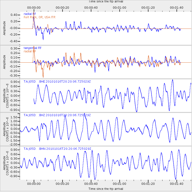
J05D Fort Rock, OR, USA - Earthquake Result Viewer
*The percent match for this event was below the threshold and hence no stack was calculated.
| Earthquake location: |
Tonga Islands |
| Earthquake latitude/longitude: |
-20.4/-173.8 |
| Earthquake time(UTC): |
2010/10/16 (289) 20:08:30 GMT |
| Earthquake Depth: |
8.0 km |
| Earthquake Magnitude: |
6.1 MB, 5.9 MS, 5.9 MW, 5.8 MW |
| Earthquake Catalog/Contributor: |
WHDF/NEIC |
|
| Network: |
TA USArray Transportable Network (new EarthScope stations) |
| Station: |
J05D Fort Rock, OR, USA |
| Lat/Lon: |
43.28 N/121.23 W |
| Elevation: |
1541 m |
|
| Distance: |
79.7 deg |
| Az: |
36.138 deg |
| Baz: |
229.242 deg |
| Ray Param: |
$rayparam |
*The percent match for this event was below the threshold and hence was not used in the summary stack. |
|
| Radial Match: |
72.91552 % |
| Radial Bump: |
400 |
| Transverse Match: |
55.93086 % |
| Transverse Bump: |
400 |
| SOD ConfigId: |
339645 |
| Insert Time: |
2011-02-17 08:35:30.954 +0000 |
| GWidth: |
2.5 |
| Max Bumps: |
400 |
| Tol: |
0.001 |
|
Signal To Noise
| Channel | StoN | STA | LTA |
| TA:J05D: :BHZ:20101016T20:20:06.725029Z | 2.0933278 | 5.1058817E-7 | 2.4391218E-7 |
| TA:J05D: :BHN:20101016T20:20:06.725029Z | 0.90780944 | 2.166877E-7 | 2.3869293E-7 |
| TA:J05D: :BHE:20101016T20:20:06.725029Z | 0.5792218 | 2.0606963E-7 | 3.5576983E-7 |
| Arrivals |
| Ps | |
| PpPs | |
| PsPs/PpSs | |


