You are here: Home > Network List > TA - USArray Transportable Network (new EarthScope stations) Stations List
> Station V34A Guthrie, OK, USA > Earthquake Result Viewer
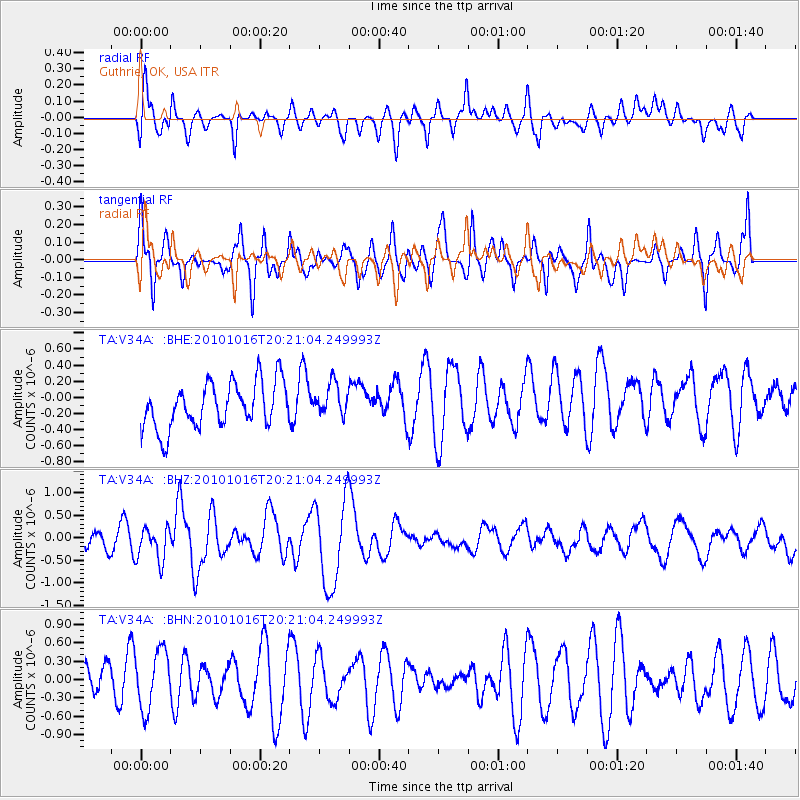
V34A Guthrie, OK, USA - Earthquake Result Viewer
*The percent match for this event was below the threshold and hence no stack was calculated.
| Earthquake location: |
Tonga Islands |
| Earthquake latitude/longitude: |
-20.4/-173.8 |
| Earthquake time(UTC): |
2010/10/16 (289) 20:08:30 GMT |
| Earthquake Depth: |
8.0 km |
| Earthquake Magnitude: |
6.1 MB, 5.9 MS, 5.9 MW, 5.8 MW |
| Earthquake Catalog/Contributor: |
WHDF/NEIC |
|
| Network: |
TA USArray Transportable Network (new EarthScope stations) |
| Station: |
V34A Guthrie, OK, USA |
| Lat/Lon: |
35.83 N/97.52 W |
| Elevation: |
329 m |
|
| Distance: |
91.3 deg |
| Az: |
52.161 deg |
| Baz: |
245.728 deg |
| Ray Param: |
$rayparam |
*The percent match for this event was below the threshold and hence was not used in the summary stack. |
|
| Radial Match: |
63.09042 % |
| Radial Bump: |
400 |
| Transverse Match: |
57.652763 % |
| Transverse Bump: |
400 |
| SOD ConfigId: |
339645 |
| Insert Time: |
2011-02-17 08:36:11.224 +0000 |
| GWidth: |
2.5 |
| Max Bumps: |
400 |
| Tol: |
0.001 |
|
Signal To Noise
| Channel | StoN | STA | LTA |
| TA:V34A: :BHZ:20101016T20:21:04.249993Z | 1.8071387 | 3.7349838E-7 | 2.0667943E-7 |
| TA:V34A: :BHN:20101016T20:21:04.249993Z | 1.3535768 | 4.783083E-7 | 3.5336623E-7 |
| TA:V34A: :BHE:20101016T20:21:04.249993Z | 0.7134234 | 2.0010174E-7 | 2.8048106E-7 |
| Arrivals |
| Ps | |
| PpPs | |
| PsPs/PpSs | |


