You are here: Home > Network List > TA - USArray Transportable Network (new EarthScope stations) Stations List
> Station F35A Swanville, MN, USA > Earthquake Result Viewer
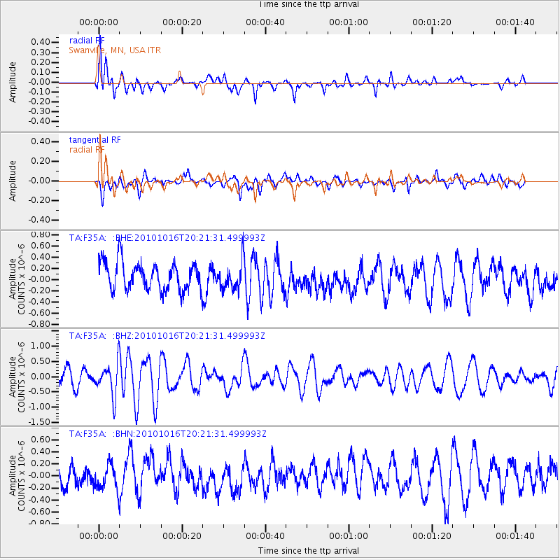
F35A Swanville, MN, USA - Earthquake Result Viewer
*The percent match for this event was below the threshold and hence no stack was calculated.
| Earthquake location: |
Tonga Islands |
| Earthquake latitude/longitude: |
-20.4/-173.8 |
| Earthquake time(UTC): |
2010/10/16 (289) 20:08:30 GMT |
| Earthquake Depth: |
8.0 km |
| Earthquake Magnitude: |
6.1 MB, 5.9 MS, 5.9 MW, 5.8 MW |
| Earthquake Catalog/Contributor: |
WHDF/NEIC |
|
| Network: |
TA USArray Transportable Network (new EarthScope stations) |
| Station: |
F35A Swanville, MN, USA |
| Lat/Lon: |
45.86 N/94.57 W |
| Elevation: |
376 m |
|
| Distance: |
97.2 deg |
| Az: |
43.8 deg |
| Baz: |
248.275 deg |
| Ray Param: |
$rayparam |
*The percent match for this event was below the threshold and hence was not used in the summary stack. |
|
| Radial Match: |
65.782616 % |
| Radial Bump: |
400 |
| Transverse Match: |
59.084957 % |
| Transverse Bump: |
399 |
| SOD ConfigId: |
339645 |
| Insert Time: |
2011-02-17 08:42:44.507 +0000 |
| GWidth: |
2.5 |
| Max Bumps: |
400 |
| Tol: |
0.001 |
|
Signal To Noise
| Channel | StoN | STA | LTA |
| TA:F35A: :BHZ:20101016T20:21:31.499993Z | 2.329147 | 5.5116226E-7 | 2.3663695E-7 |
| TA:F35A: :BHN:20101016T20:21:31.499993Z | 1.1175014 | 2.1081328E-7 | 1.8864701E-7 |
| TA:F35A: :BHE:20101016T20:21:31.499993Z | 1.0032517 | 2.477635E-7 | 2.4696047E-7 |
| Arrivals |
| Ps | |
| PpPs | |
| PsPs/PpSs | |


