You are here: Home > Network List > US - United States National Seismic Network Stations List
> Station AMTX Amarillo, Texas, USA > Earthquake Result Viewer
AMTX Amarillo, Texas, USA - Earthquake Result Viewer
*The percent match for this event was below the threshold and hence no stack was calculated.
| Earthquake location: |
Tonga Islands |
| Earthquake latitude/longitude: |
-20.4/-173.8 |
| Earthquake time(UTC): |
2010/10/16 (289) 20:08:30 GMT |
| Earthquake Depth: |
8.0 km |
| Earthquake Magnitude: |
6.1 MB, 5.9 MS, 5.9 MW, 5.8 MW |
| Earthquake Catalog/Contributor: |
WHDF/NEIC |
|
| Network: |
US United States National Seismic Network |
| Station: |
AMTX Amarillo, Texas, USA |
| Lat/Lon: |
34.53 N/101.41 W |
| Elevation: |
1010 m |
|
| Distance: |
87.8 deg |
| Az: |
51.97 deg |
| Baz: |
243.494 deg |
| Ray Param: |
$rayparam |
*The percent match for this event was below the threshold and hence was not used in the summary stack. |
|
| Radial Match: |
71.99632 % |
| Radial Bump: |
400 |
| Transverse Match: |
49.720875 % |
| Transverse Bump: |
345 |
| SOD ConfigId: |
339645 |
| Insert Time: |
2011-02-17 08:45:14.595 +0000 |
| GWidth: |
2.5 |
| Max Bumps: |
400 |
| Tol: |
0.001 |
|
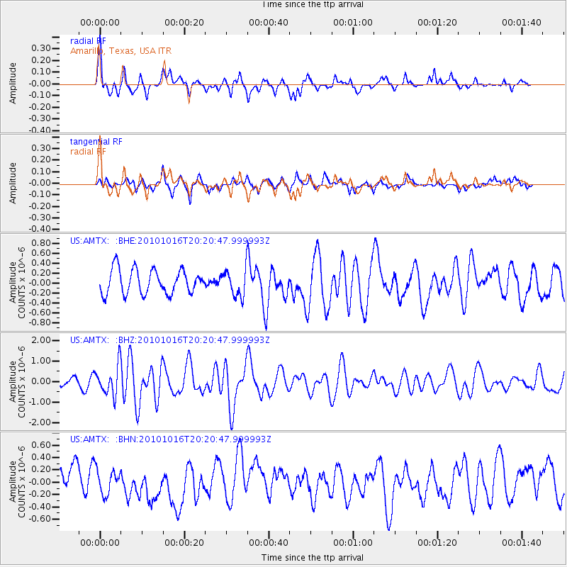
Signal To Noise
| Channel | StoN | STA | LTA |
| US:AMTX: :BHZ:20101016T20:20:47.999993Z | 3.660466 | 7.2819284E-7 | 1.9893447E-7 |
| US:AMTX: :BHN:20101016T20:20:47.999993Z | 0.797842 | 1.8850844E-7 | 2.3627288E-7 |
| US:AMTX: :BHE:20101016T20:20:47.999993Z | 1.2694697 | 3.103755E-7 | 2.4449224E-7 |
| Arrivals |
| Ps | |
| PpPs | |
| PsPs/PpSs | |


