You are here: Home > Network List > UW - Pacific Northwest Regional Seismic Network Stations List
> Station PASS Maple Falls, WA, USA > Earthquake Result Viewer
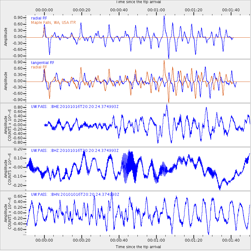
PASS Maple Falls, WA, USA - Earthquake Result Viewer
*The percent match for this event was below the threshold and hence no stack was calculated.
| Earthquake location: |
Tonga Islands |
| Earthquake latitude/longitude: |
-20.4/-173.8 |
| Earthquake time(UTC): |
2010/10/16 (289) 20:08:30 GMT |
| Earthquake Depth: |
8.0 km |
| Earthquake Magnitude: |
6.1 MB, 5.9 MS, 5.9 MW, 5.8 MW |
| Earthquake Catalog/Contributor: |
WHDF/NEIC |
|
| Network: |
UW Pacific Northwest Regional Seismic Network |
| Station: |
PASS Maple Falls, WA, USA |
| Lat/Lon: |
49.00 N/122.09 W |
| Elevation: |
174 m |
|
| Distance: |
83.0 deg |
| Az: |
31.408 deg |
| Baz: |
227.919 deg |
| Ray Param: |
$rayparam |
*The percent match for this event was below the threshold and hence was not used in the summary stack. |
|
| Radial Match: |
57.228123 % |
| Radial Bump: |
400 |
| Transverse Match: |
57.772057 % |
| Transverse Bump: |
400 |
| SOD ConfigId: |
339645 |
| Insert Time: |
2011-02-17 08:46:26.531 +0000 |
| GWidth: |
2.5 |
| Max Bumps: |
400 |
| Tol: |
0.001 |
|
Signal To Noise
| Channel | StoN | STA | LTA |
| UW:PASS: :BHZ:20101016T20:20:24.374993Z | 2.0094917 | 2.0068927E-7 | 9.987067E-8 |
| UW:PASS: :BHN:20101016T20:20:24.374993Z | 0.77907217 | 1.659578E-7 | 2.1301982E-7 |
| UW:PASS: :BHE:20101016T20:20:24.374993Z | 0.8483353 | 1.00269936E-7 | 1.18196105E-7 |
| Arrivals |
| Ps | |
| PpPs | |
| PsPs/PpSs | |


