You are here: Home > Network List > TA - USArray Transportable Network (new EarthScope stations) Stations List
> Station 230A Sterling City, TX, USA > Earthquake Result Viewer
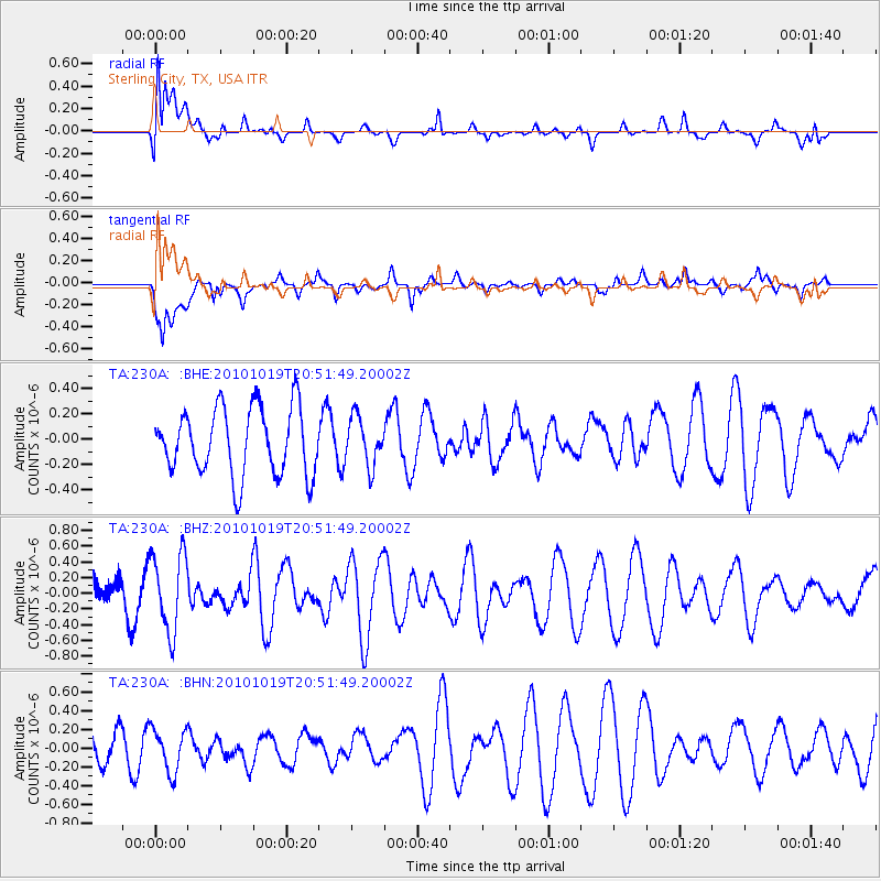
230A Sterling City, TX, USA - Earthquake Result Viewer
*The percent match for this event was below the threshold and hence no stack was calculated.
| Earthquake location: |
Tonga Islands |
| Earthquake latitude/longitude: |
-20.3/-173.8 |
| Earthquake time(UTC): |
2010/10/19 (292) 20:39:36 GMT |
| Earthquake Depth: |
10 km |
| Earthquake Magnitude: |
5.6 MB, 5.1 MS, 5.2 MW |
| Earthquake Catalog/Contributor: |
WHDF/NEIC |
|
| Network: |
TA USArray Transportable Network (new EarthScope stations) |
| Station: |
230A Sterling City, TX, USA |
| Lat/Lon: |
31.89 N/101.11 W |
| Elevation: |
742 m |
|
| Distance: |
86.8 deg |
| Az: |
54.419 deg |
| Baz: |
243.782 deg |
| Ray Param: |
$rayparam |
*The percent match for this event was below the threshold and hence was not used in the summary stack. |
|
| Radial Match: |
56.481678 % |
| Radial Bump: |
400 |
| Transverse Match: |
56.542442 % |
| Transverse Bump: |
400 |
| SOD ConfigId: |
339645 |
| Insert Time: |
2011-02-17 08:52:32.727 +0000 |
| GWidth: |
2.5 |
| Max Bumps: |
400 |
| Tol: |
0.001 |
|
Signal To Noise
| Channel | StoN | STA | LTA |
| TA:230A: :BHZ:20101019T20:51:49.20002Z | 2.6352124 | 4.955838E-7 | 1.8806217E-7 |
| TA:230A: :BHN:20101019T20:51:49.20002Z | 1.2355676 | 2.2896674E-7 | 1.8531301E-7 |
| TA:230A: :BHE:20101019T20:51:49.20002Z | 0.7077475 | 1.8673364E-7 | 2.6384217E-7 |
| Arrivals |
| Ps | |
| PpPs | |
| PsPs/PpSs | |


