You are here: Home > Network List > TA - USArray Transportable Network (new EarthScope stations) Stations List
> Station L02D Cave Junction, OR, USA > Earthquake Result Viewer
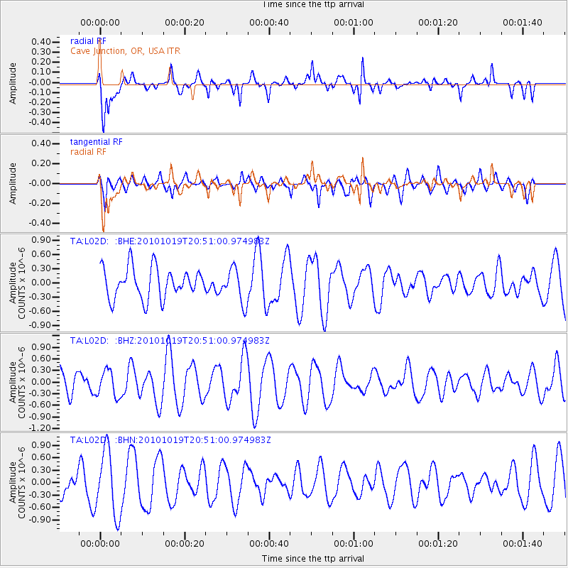
L02D Cave Junction, OR, USA - Earthquake Result Viewer
*The percent match for this event was below the threshold and hence no stack was calculated.
| Earthquake location: |
Tonga Islands |
| Earthquake latitude/longitude: |
-20.3/-173.8 |
| Earthquake time(UTC): |
2010/10/19 (292) 20:39:36 GMT |
| Earthquake Depth: |
10 km |
| Earthquake Magnitude: |
5.6 MB, 5.1 MS, 5.2 MW |
| Earthquake Catalog/Contributor: |
WHDF/NEIC |
|
| Network: |
TA USArray Transportable Network (new EarthScope stations) |
| Station: |
L02D Cave Junction, OR, USA |
| Lat/Lon: |
42.16 N/123.60 W |
| Elevation: |
458 m |
|
| Distance: |
77.5 deg |
| Az: |
35.786 deg |
| Baz: |
227.56 deg |
| Ray Param: |
$rayparam |
*The percent match for this event was below the threshold and hence was not used in the summary stack. |
|
| Radial Match: |
57.341816 % |
| Radial Bump: |
370 |
| Transverse Match: |
66.10602 % |
| Transverse Bump: |
400 |
| SOD ConfigId: |
339645 |
| Insert Time: |
2011-02-17 08:54:04.173 +0000 |
| GWidth: |
2.5 |
| Max Bumps: |
400 |
| Tol: |
0.001 |
|
Signal To Noise
| Channel | StoN | STA | LTA |
| TA:L02D: :BHZ:20101019T20:51:00.974983Z | 0.6412446 | 3.4202418E-7 | 5.3337556E-7 |
| TA:L02D: :BHN:20101019T20:51:00.974983Z | 3.956433 | 7.888562E-7 | 1.993857E-7 |
| TA:L02D: :BHE:20101019T20:51:00.974983Z | 1.1652809 | 3.7683398E-7 | 3.2338465E-7 |
| Arrivals |
| Ps | |
| PpPs | |
| PsPs/PpSs | |


