You are here: Home > Network List > TA - USArray Transportable Network (new EarthScope stations) Stations List
> Station 234A Clairette, TX, USA > Earthquake Result Viewer
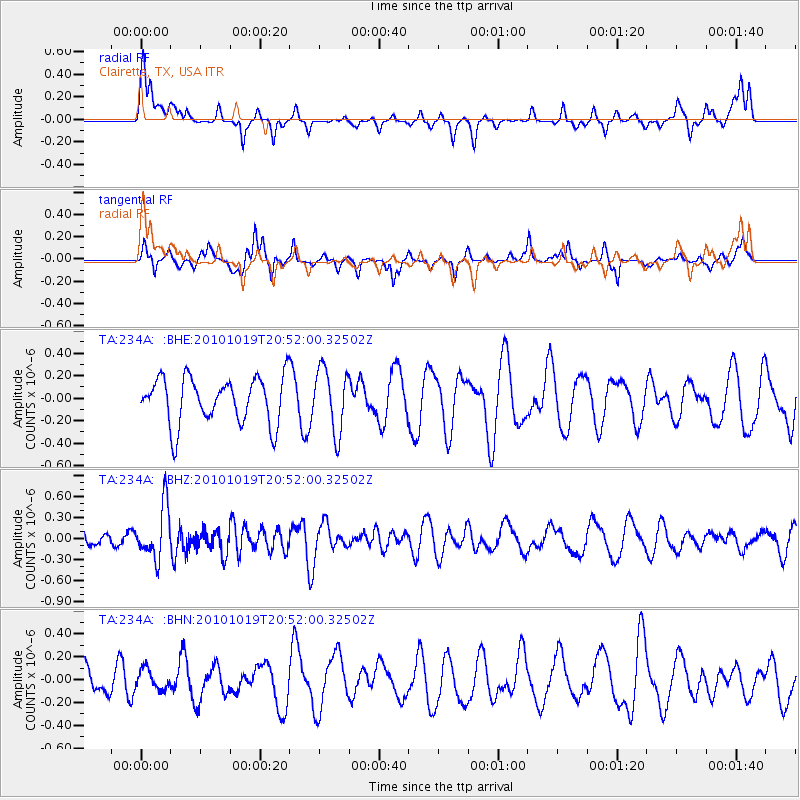
234A Clairette, TX, USA - Earthquake Result Viewer
*The percent match for this event was below the threshold and hence no stack was calculated.
| Earthquake location: |
Tonga Islands |
| Earthquake latitude/longitude: |
-20.3/-173.8 |
| Earthquake time(UTC): |
2010/10/19 (292) 20:39:36 GMT |
| Earthquake Depth: |
10 km |
| Earthquake Magnitude: |
5.6 MB, 5.1 MS, 5.2 MW |
| Earthquake Catalog/Contributor: |
WHDF/NEIC |
|
| Network: |
TA USArray Transportable Network (new EarthScope stations) |
| Station: |
234A Clairette, TX, USA |
| Lat/Lon: |
32.00 N/98.14 W |
| Elevation: |
358 m |
|
| Distance: |
89.1 deg |
| Az: |
55.401 deg |
| Baz: |
245.385 deg |
| Ray Param: |
$rayparam |
*The percent match for this event was below the threshold and hence was not used in the summary stack. |
|
| Radial Match: |
41.766632 % |
| Radial Bump: |
306 |
| Transverse Match: |
55.95794 % |
| Transverse Bump: |
266 |
| SOD ConfigId: |
339645 |
| Insert Time: |
2011-02-17 08:54:15.664 +0000 |
| GWidth: |
2.5 |
| Max Bumps: |
400 |
| Tol: |
0.001 |
|
Signal To Noise
| Channel | StoN | STA | LTA |
| TA:234A: :BHZ:20101019T20:52:00.32502Z | 2.3308032 | 3.7390726E-7 | 1.6041992E-7 |
| TA:234A: :BHN:20101019T20:52:00.32502Z | 0.68749714 | 8.601551E-8 | 1.25114E-7 |
| TA:234A: :BHE:20101019T20:52:00.32502Z | 1.3628137 | 2.8101022E-7 | 2.0619855E-7 |
| Arrivals |
| Ps | |
| PpPs | |
| PsPs/PpSs | |


