You are here: Home > Network List > TA - USArray Transportable Network (new EarthScope stations) Stations List
> Station 121A Cookes Peak, Deming, NM, USA > Earthquake Result Viewer
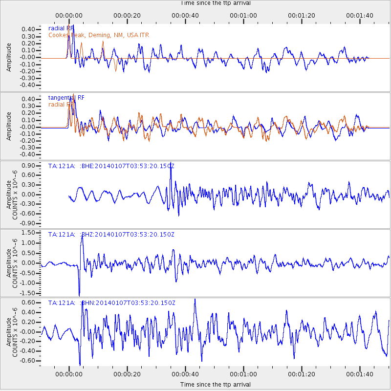
121A Cookes Peak, Deming, NM, USA - Earthquake Result Viewer
*The percent match for this event was below the threshold and hence no stack was calculated.
| Earthquake location: |
Northern Chile |
| Earthquake latitude/longitude: |
-21.0/-69.7 |
| Earthquake time(UTC): |
2014/01/07 (007) 03:43:23 GMT |
| Earthquake Depth: |
87 km |
| Earthquake Magnitude: |
5.4 MW |
| Earthquake Catalog/Contributor: |
ISC/ISC |
|
| Network: |
TA USArray Transportable Network (new EarthScope stations) |
| Station: |
121A Cookes Peak, Deming, NM, USA |
| Lat/Lon: |
32.53 N/107.79 W |
| Elevation: |
1652 m |
|
| Distance: |
64.5 deg |
| Az: |
324.758 deg |
| Baz: |
140.34 deg |
| Ray Param: |
$rayparam |
*The percent match for this event was below the threshold and hence was not used in the summary stack. |
|
| Radial Match: |
61.347435 % |
| Radial Bump: |
400 |
| Transverse Match: |
68.4738 % |
| Transverse Bump: |
400 |
| SOD ConfigId: |
3390531 |
| Insert Time: |
2019-04-09 22:02:34.305 +0000 |
| GWidth: |
2.5 |
| Max Bumps: |
400 |
| Tol: |
0.001 |
|
Signal To Noise
| Channel | StoN | STA | LTA |
| TA:121A: :BHZ:20140107T03:53:20.150Z | 6.4004145 | 6.174479E-7 | 9.646999E-8 |
| TA:121A: :BHN:20140107T03:53:20.150Z | 2.6743352 | 2.6947998E-7 | 1.0076523E-7 |
| TA:121A: :BHE:20140107T03:53:20.150Z | 2.0504968 | 2.380398E-7 | 1.1608885E-7 |
| Arrivals |
| Ps | |
| PpPs | |
| PsPs/PpSs | |


