You are here: Home > Network List > TA - USArray Transportable Network (new EarthScope stations) Stations List
> Station P28A Satin Francis, KS, USA > Earthquake Result Viewer
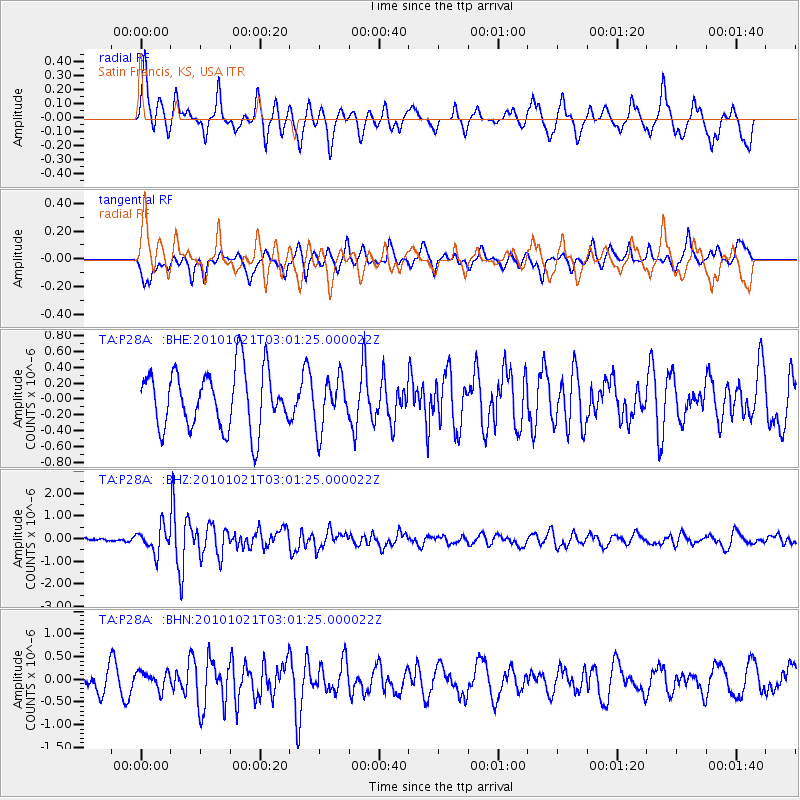
P28A Satin Francis, KS, USA - Earthquake Result Viewer
*The percent match for this event was below the threshold and hence no stack was calculated.
| Earthquake location: |
Off Coast Of Central Chile |
| Earthquake latitude/longitude: |
-34.7/-73.7 |
| Earthquake time(UTC): |
2010/10/21 (294) 02:49:56 GMT |
| Earthquake Depth: |
10 km |
| Earthquake Magnitude: |
5.9 MB, 5.5 MS, 5.9 MW, 5.8 MW |
| Earthquake Catalog/Contributor: |
WHDF/NEIC |
|
| Network: |
TA USArray Transportable Network (new EarthScope stations) |
| Station: |
P28A Satin Francis, KS, USA |
| Lat/Lon: |
39.57 N/101.75 W |
| Elevation: |
1105 m |
|
| Distance: |
78.3 deg |
| Az: |
338.229 deg |
| Baz: |
156.721 deg |
| Ray Param: |
$rayparam |
*The percent match for this event was below the threshold and hence was not used in the summary stack. |
|
| Radial Match: |
56.91413 % |
| Radial Bump: |
399 |
| Transverse Match: |
45.51567 % |
| Transverse Bump: |
366 |
| SOD ConfigId: |
339645 |
| Insert Time: |
2011-02-17 09:19:53.684 +0000 |
| GWidth: |
2.5 |
| Max Bumps: |
400 |
| Tol: |
0.001 |
|
Signal To Noise
| Channel | StoN | STA | LTA |
| TA:P28A: :BHZ:20101021T03:01:25.000022Z | 4.7422814 | 5.4725797E-7 | 1.1539972E-7 |
| TA:P28A: :BHN:20101021T03:01:25.000022Z | 0.39264074 | 2.0271368E-7 | 5.1628285E-7 |
| TA:P28A: :BHE:20101021T03:01:25.000022Z | 0.84279716 | 3.1101965E-7 | 3.6903265E-7 |
| Arrivals |
| Ps | |
| PpPs | |
| PsPs/PpSs | |


