You are here: Home > Network List > TA - USArray Transportable Network (new EarthScope stations) Stations List
> Station H27A Howes, SD, USA > Earthquake Result Viewer
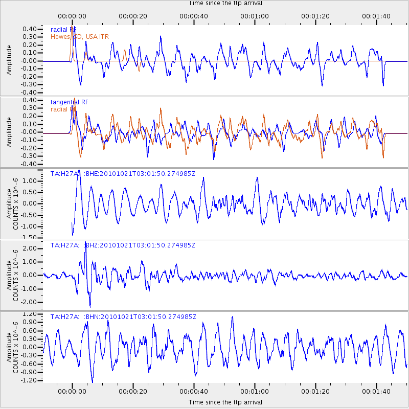
H27A Howes, SD, USA - Earthquake Result Viewer
*The percent match for this event was below the threshold and hence no stack was calculated.
| Earthquake location: |
Off Coast Of Central Chile |
| Earthquake latitude/longitude: |
-34.7/-73.7 |
| Earthquake time(UTC): |
2010/10/21 (294) 02:49:56 GMT |
| Earthquake Depth: |
10 km |
| Earthquake Magnitude: |
5.9 MB, 5.5 MS, 5.9 MW, 5.8 MW |
| Earthquake Catalog/Contributor: |
WHDF/NEIC |
|
| Network: |
TA USArray Transportable Network (new EarthScope stations) |
| Station: |
H27A Howes, SD, USA |
| Lat/Lon: |
44.63 N/102.08 W |
| Elevation: |
748 m |
|
| Distance: |
83.1 deg |
| Az: |
340.026 deg |
| Baz: |
156.795 deg |
| Ray Param: |
$rayparam |
*The percent match for this event was below the threshold and hence was not used in the summary stack. |
|
| Radial Match: |
75.8829 % |
| Radial Bump: |
400 |
| Transverse Match: |
51.205612 % |
| Transverse Bump: |
400 |
| SOD ConfigId: |
339645 |
| Insert Time: |
2011-02-17 09:21:26.151 +0000 |
| GWidth: |
2.5 |
| Max Bumps: |
400 |
| Tol: |
0.001 |
|
Signal To Noise
| Channel | StoN | STA | LTA |
| TA:H27A: :BHZ:20101021T03:01:50.274985Z | 3.4943423 | 8.5605063E-7 | 2.449819E-7 |
| TA:H27A: :BHN:20101021T03:01:50.274985Z | 1.2773697 | 4.56146E-7 | 3.5709786E-7 |
| TA:H27A: :BHE:20101021T03:01:50.274985Z | 0.87257296 | 5.073079E-7 | 5.8139307E-7 |
| Arrivals |
| Ps | |
| PpPs | |
| PsPs/PpSs | |


