You are here: Home > Network List > TA - USArray Transportable Network (new EarthScope stations) Stations List
> Station U37A Salina, OK, USA > Earthquake Result Viewer
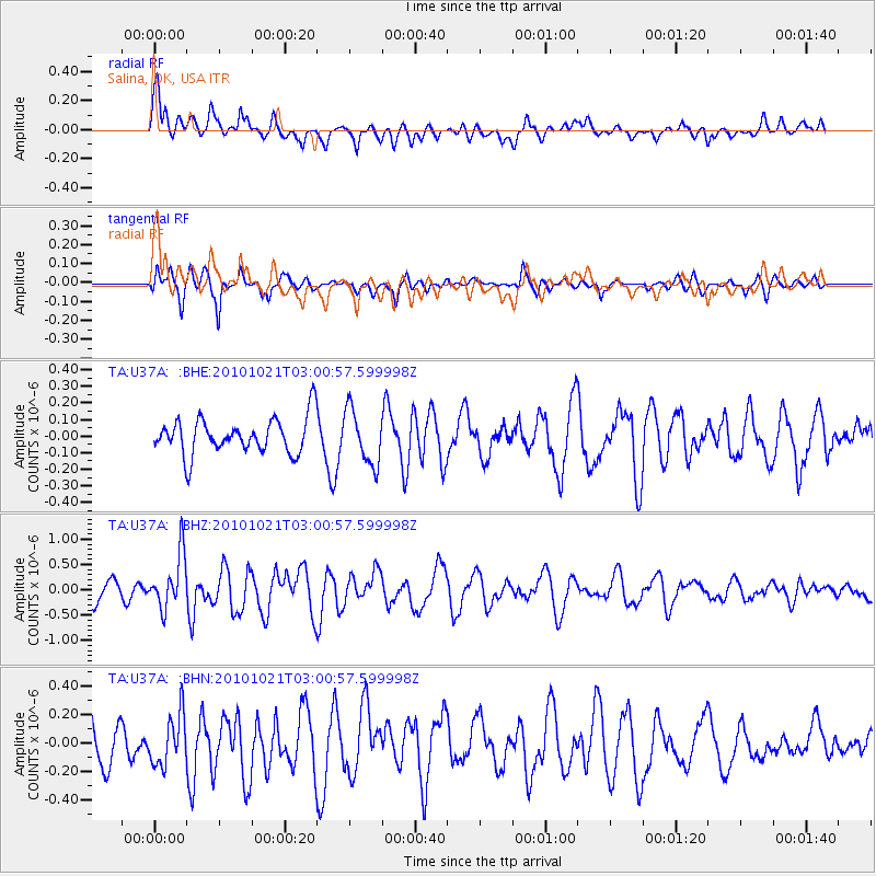
U37A Salina, OK, USA - Earthquake Result Viewer
*The percent match for this event was below the threshold and hence no stack was calculated.
| Earthquake location: |
Off Coast Of Central Chile |
| Earthquake latitude/longitude: |
-34.7/-73.7 |
| Earthquake time(UTC): |
2010/10/21 (294) 02:49:56 GMT |
| Earthquake Depth: |
10 km |
| Earthquake Magnitude: |
5.9 MB, 5.5 MS, 5.9 MW, 5.8 MW |
| Earthquake Catalog/Contributor: |
WHDF/NEIC |
|
| Network: |
TA USArray Transportable Network (new EarthScope stations) |
| Station: |
U37A Salina, OK, USA |
| Lat/Lon: |
36.41 N/95.12 W |
| Elevation: |
248 m |
|
| Distance: |
73.5 deg |
| Az: |
342.129 deg |
| Baz: |
161.743 deg |
| Ray Param: |
$rayparam |
*The percent match for this event was below the threshold and hence was not used in the summary stack. |
|
| Radial Match: |
65.87094 % |
| Radial Bump: |
400 |
| Transverse Match: |
62.806786 % |
| Transverse Bump: |
400 |
| SOD ConfigId: |
339645 |
| Insert Time: |
2011-02-17 09:35:27.633 +0000 |
| GWidth: |
2.5 |
| Max Bumps: |
400 |
| Tol: |
0.001 |
|
Signal To Noise
| Channel | StoN | STA | LTA |
| TA:U37A: :BHZ:20101021T03:00:57.599998Z | 3.430403 | 5.278182E-7 | 1.5386479E-7 |
| TA:U37A: :BHN:20101021T03:00:57.599998Z | 1.3521115 | 1.7608187E-7 | 1.3022733E-7 |
| TA:U37A: :BHE:20101021T03:00:57.599998Z | 1.5266831 | 1.6323533E-7 | 1.0692155E-7 |
| Arrivals |
| Ps | |
| PpPs | |
| PsPs/PpSs | |


