You are here: Home > Network List > TA - USArray Transportable Network (new EarthScope stations) Stations List
> Station E31A Nome, ND, USA > Earthquake Result Viewer
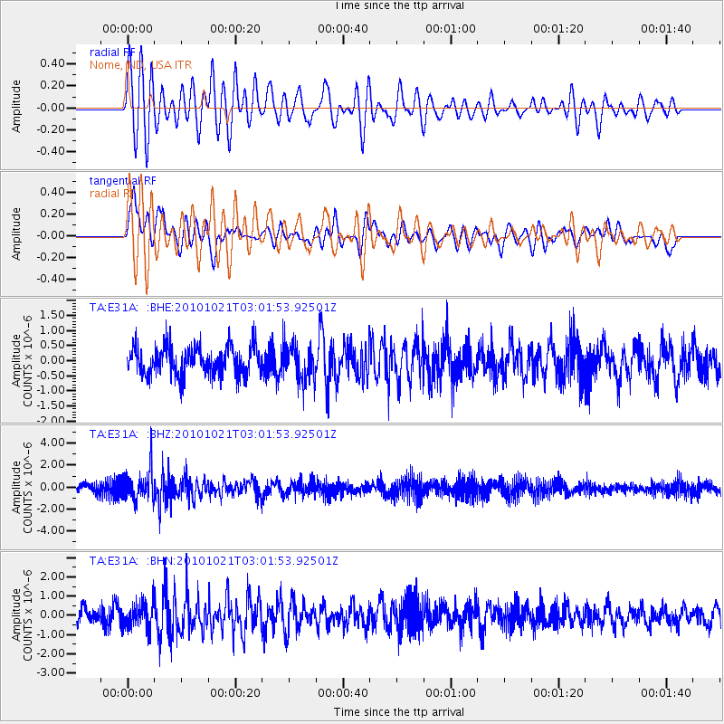
E31A Nome, ND, USA - Earthquake Result Viewer
*The percent match for this event was below the threshold and hence no stack was calculated.
| Earthquake location: |
Off Coast Of Central Chile |
| Earthquake latitude/longitude: |
-34.7/-73.7 |
| Earthquake time(UTC): |
2010/10/21 (294) 02:49:56 GMT |
| Earthquake Depth: |
10 km |
| Earthquake Magnitude: |
5.9 MB, 5.5 MS, 5.9 MW, 5.8 MW |
| Earthquake Catalog/Contributor: |
WHDF/NEIC |
|
| Network: |
TA USArray Transportable Network (new EarthScope stations) |
| Station: |
E31A Nome, ND, USA |
| Lat/Lon: |
46.56 N/97.89 W |
| Elevation: |
427 m |
|
| Distance: |
83.8 deg |
| Az: |
343.491 deg |
| Baz: |
160.175 deg |
| Ray Param: |
$rayparam |
*The percent match for this event was below the threshold and hence was not used in the summary stack. |
|
| Radial Match: |
78.95263 % |
| Radial Bump: |
400 |
| Transverse Match: |
70.87032 % |
| Transverse Bump: |
400 |
| SOD ConfigId: |
339645 |
| Insert Time: |
2011-02-17 09:37:49.462 +0000 |
| GWidth: |
2.5 |
| Max Bumps: |
400 |
| Tol: |
0.001 |
|
Signal To Noise
| Channel | StoN | STA | LTA |
| TA:E31A: :BHZ:20101021T03:01:53.92501Z | 3.225703 | 1.3656097E-6 | 4.233526E-7 |
| TA:E31A: :BHN:20101021T03:01:53.92501Z | 1.6178684 | 6.749706E-7 | 4.1719744E-7 |
| TA:E31A: :BHE:20101021T03:01:53.92501Z | 1.2464951 | 5.871713E-7 | 4.7105783E-7 |
| Arrivals |
| Ps | |
| PpPs | |
| PsPs/PpSs | |


