You are here: Home > Network List > TA - USArray Transportable Network (new EarthScope stations) Stations List
> Station A33A Warroad, MN, USA > Earthquake Result Viewer
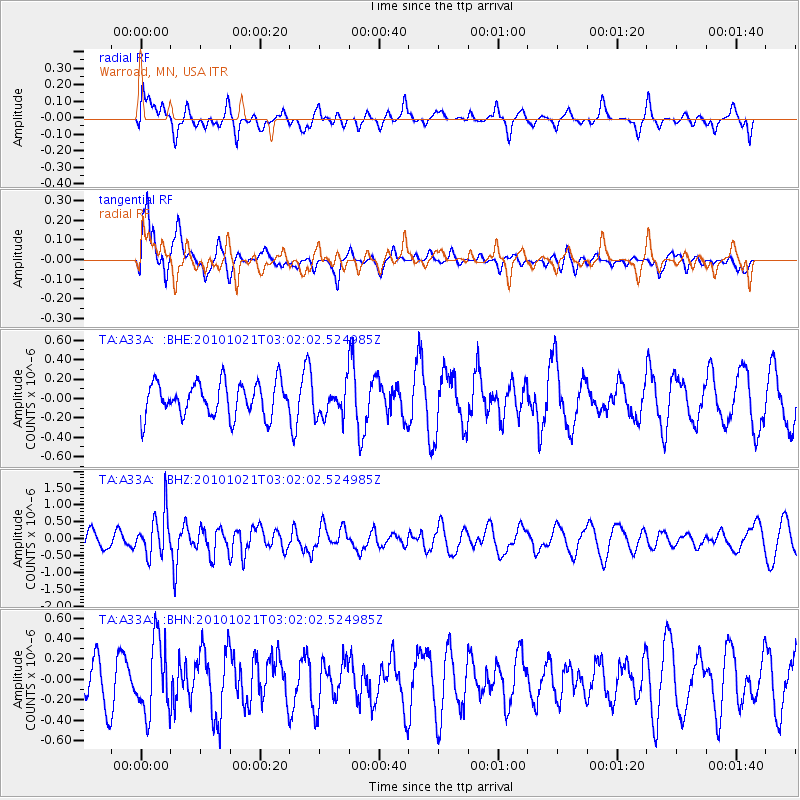
A33A Warroad, MN, USA - Earthquake Result Viewer
*The percent match for this event was below the threshold and hence no stack was calculated.
| Earthquake location: |
Off Coast Of Central Chile |
| Earthquake latitude/longitude: |
-34.7/-73.7 |
| Earthquake time(UTC): |
2010/10/21 (294) 02:49:56 GMT |
| Earthquake Depth: |
10 km |
| Earthquake Magnitude: |
5.9 MB, 5.5 MS, 5.9 MW, 5.8 MW |
| Earthquake Catalog/Contributor: |
WHDF/NEIC |
|
| Network: |
TA USArray Transportable Network (new EarthScope stations) |
| Station: |
A33A Warroad, MN, USA |
| Lat/Lon: |
48.94 N/95.39 W |
| Elevation: |
329 m |
|
| Distance: |
85.5 deg |
| Az: |
345.864 deg |
| Baz: |
162.24 deg |
| Ray Param: |
$rayparam |
*The percent match for this event was below the threshold and hence was not used in the summary stack. |
|
| Radial Match: |
40.52579 % |
| Radial Bump: |
400 |
| Transverse Match: |
69.39486 % |
| Transverse Bump: |
319 |
| SOD ConfigId: |
339645 |
| Insert Time: |
2011-02-17 09:39:47.057 +0000 |
| GWidth: |
2.5 |
| Max Bumps: |
400 |
| Tol: |
0.001 |
|
Signal To Noise
| Channel | StoN | STA | LTA |
| TA:A33A: :BHZ:20101021T03:02:02.524985Z | 3.5151103 | 6.361343E-7 | 1.8097136E-7 |
| TA:A33A: :BHN:20101021T03:02:02.524985Z | 1.8483745 | 3.582101E-7 | 1.9379735E-7 |
| TA:A33A: :BHE:20101021T03:02:02.524985Z | 0.94775534 | 1.6344777E-7 | 1.7245777E-7 |
| Arrivals |
| Ps | |
| PpPs | |
| PsPs/PpSs | |


