You are here: Home > Network List > IW - Intermountain West Stations List
> Station PLID Pearl Lake, Idaho, USA > Earthquake Result Viewer
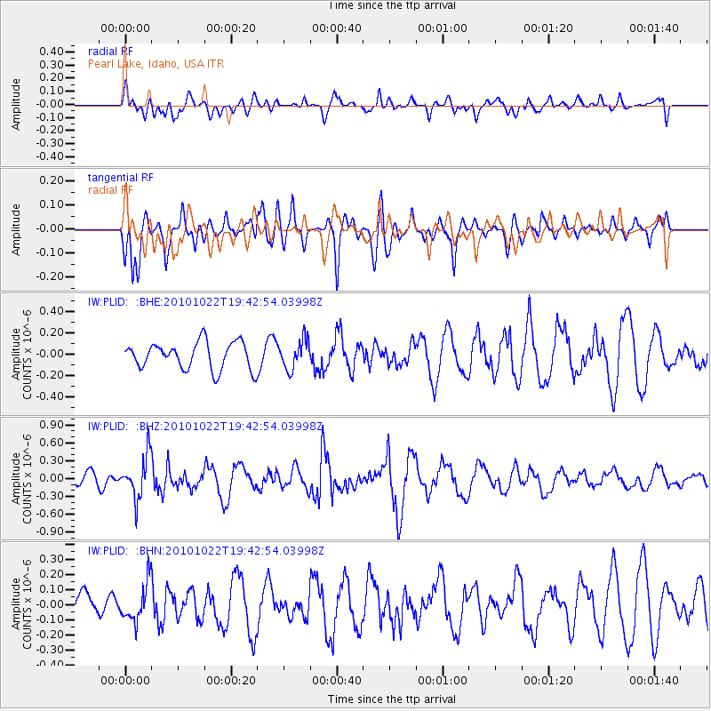
PLID Pearl Lake, Idaho, USA - Earthquake Result Viewer
*The percent match for this event was below the threshold and hence no stack was calculated.
| Earthquake location: |
Chile-Bolivia Border Region |
| Earthquake latitude/longitude: |
-20.9/-68.4 |
| Earthquake time(UTC): |
2010/10/22 (295) 19:31:37 GMT |
| Earthquake Depth: |
132 km |
| Earthquake Magnitude: |
5.8 MW, 5.4 MB, 5.8 MW |
| Earthquake Catalog/Contributor: |
WHDF/NEIC |
|
| Network: |
IW Intermountain West |
| Station: |
PLID Pearl Lake, Idaho, USA |
| Lat/Lon: |
45.09 N/116.00 W |
| Elevation: |
2164 m |
|
| Distance: |
78.7 deg |
| Az: |
327.741 deg |
| Baz: |
135.204 deg |
| Ray Param: |
$rayparam |
*The percent match for this event was below the threshold and hence was not used in the summary stack. |
|
| Radial Match: |
59.82858 % |
| Radial Bump: |
400 |
| Transverse Match: |
69.736465 % |
| Transverse Bump: |
400 |
| SOD ConfigId: |
339645 |
| Insert Time: |
2011-02-24 07:39:43.381 +0000 |
| GWidth: |
2.5 |
| Max Bumps: |
400 |
| Tol: |
0.001 |
|
Signal To Noise
| Channel | StoN | STA | LTA |
| IW:PLID: :BHZ:20101022T19:42:54.03998Z | 1.7299176 | 3.5426754E-7 | 2.0478866E-7 |
| IW:PLID: :BHN:20101022T19:42:54.03998Z | 1.6569611 | 1.2760204E-7 | 7.700967E-8 |
| IW:PLID: :BHE:20101022T19:42:54.03998Z | 1.0883511 | 1.3635088E-7 | 1.2528207E-7 |
| Arrivals |
| Ps | |
| PpPs | |
| PsPs/PpSs | |


