You are here: Home > Network List > TA - USArray Transportable Network (new EarthScope stations) Stations List
> Station 531A Rocksprings, TX, USA > Earthquake Result Viewer
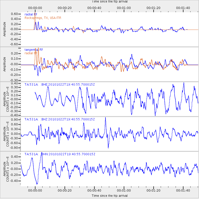
531A Rocksprings, TX, USA - Earthquake Result Viewer
*The percent match for this event was below the threshold and hence no stack was calculated.
| Earthquake location: |
Chile-Bolivia Border Region |
| Earthquake latitude/longitude: |
-20.9/-68.4 |
| Earthquake time(UTC): |
2010/10/22 (295) 19:31:37 GMT |
| Earthquake Depth: |
132 km |
| Earthquake Magnitude: |
5.8 MW, 5.4 MB, 5.8 MW |
| Earthquake Catalog/Contributor: |
WHDF/NEIC |
|
| Network: |
TA USArray Transportable Network (new EarthScope stations) |
| Station: |
531A Rocksprings, TX, USA |
| Lat/Lon: |
30.16 N/100.55 W |
| Elevation: |
661 m |
|
| Distance: |
59.4 deg |
| Az: |
327.62 deg |
| Baz: |
144.672 deg |
| Ray Param: |
$rayparam |
*The percent match for this event was below the threshold and hence was not used in the summary stack. |
|
| Radial Match: |
29.219637 % |
| Radial Bump: |
373 |
| Transverse Match: |
69.537834 % |
| Transverse Bump: |
400 |
| SOD ConfigId: |
339645 |
| Insert Time: |
2011-02-24 07:42:34.444 +0000 |
| GWidth: |
2.5 |
| Max Bumps: |
400 |
| Tol: |
0.001 |
|
Signal To Noise
| Channel | StoN | STA | LTA |
| TA:531A: :BHZ:20101022T19:40:55.700015Z | 2.3686688 | 3.451616E-7 | 1.4571965E-7 |
| TA:531A: :BHN:20101022T19:40:55.700015Z | 2.5011845 | 3.4238238E-7 | 1.3688809E-7 |
| TA:531A: :BHE:20101022T19:40:55.700015Z | 1.9438761 | 2.2102574E-7 | 1.13703614E-7 |
| Arrivals |
| Ps | |
| PpPs | |
| PsPs/PpSs | |


