You are here: Home > Network List > TA - USArray Transportable Network (new EarthScope stations) Stations List
> Station F29A Eureka, SD, USA > Earthquake Result Viewer
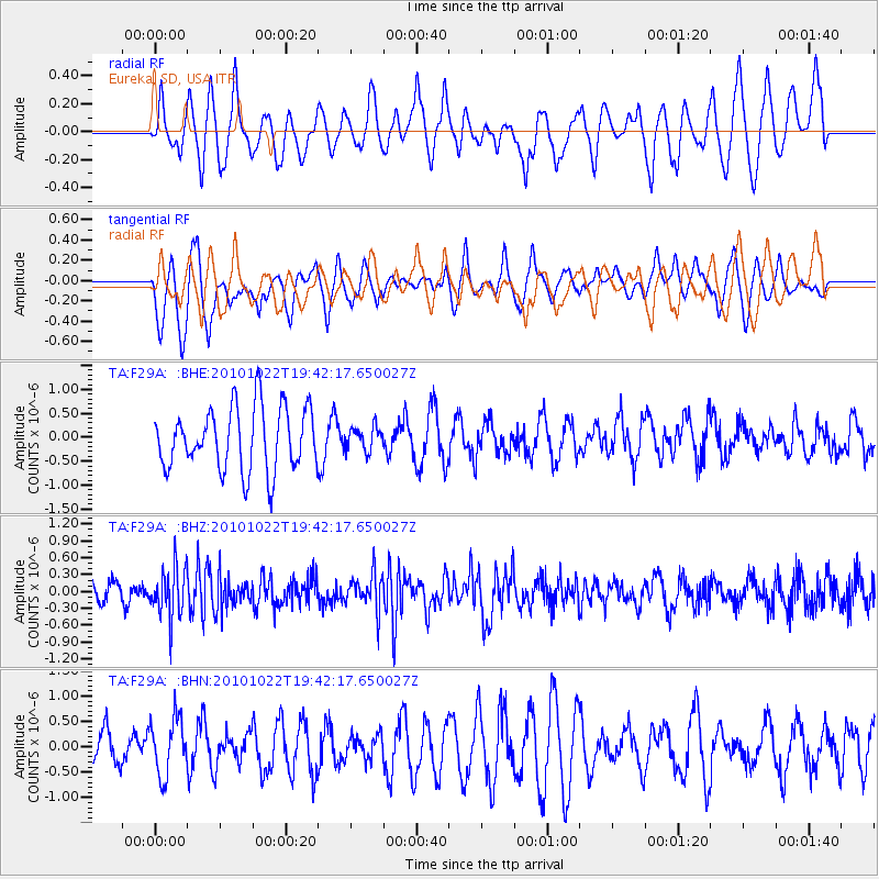
F29A Eureka, SD, USA - Earthquake Result Viewer
*The percent match for this event was below the threshold and hence no stack was calculated.
| Earthquake location: |
Chile-Bolivia Border Region |
| Earthquake latitude/longitude: |
-20.9/-68.4 |
| Earthquake time(UTC): |
2010/10/22 (295) 19:31:37 GMT |
| Earthquake Depth: |
132 km |
| Earthquake Magnitude: |
5.8 MW, 5.4 MB, 5.8 MW |
| Earthquake Catalog/Contributor: |
WHDF/NEIC |
|
| Network: |
TA USArray Transportable Network (new EarthScope stations) |
| Station: |
F29A Eureka, SD, USA |
| Lat/Lon: |
45.83 N/99.83 W |
| Elevation: |
575 m |
|
| Distance: |
72.3 deg |
| Az: |
337.479 deg |
| Baz: |
149.183 deg |
| Ray Param: |
$rayparam |
*The percent match for this event was below the threshold and hence was not used in the summary stack. |
|
| Radial Match: |
53.179302 % |
| Radial Bump: |
377 |
| Transverse Match: |
53.28239 % |
| Transverse Bump: |
377 |
| SOD ConfigId: |
339645 |
| Insert Time: |
2011-02-24 07:48:12.379 +0000 |
| GWidth: |
2.5 |
| Max Bumps: |
400 |
| Tol: |
0.001 |
|
Signal To Noise
| Channel | StoN | STA | LTA |
| TA:F29A: :BHZ:20101022T19:42:17.650027Z | 3.1725984 | 4.402533E-7 | 1.3876743E-7 |
| TA:F29A: :BHN:20101022T19:42:17.650027Z | 1.6566389 | 5.576598E-7 | 3.3662124E-7 |
| TA:F29A: :BHE:20101022T19:42:17.650027Z | 0.37998036 | 2.4839883E-7 | 6.5371495E-7 |
| Arrivals |
| Ps | |
| PpPs | |
| PsPs/PpSs | |


