You are here: Home > Network List > TA - USArray Transportable Network (new EarthScope stations) Stations List
> Station H29A Onida, SD, USA > Earthquake Result Viewer
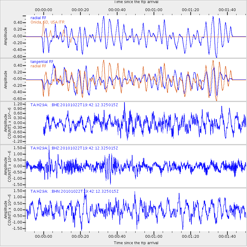
H29A Onida, SD, USA - Earthquake Result Viewer
*The percent match for this event was below the threshold and hence no stack was calculated.
| Earthquake location: |
Chile-Bolivia Border Region |
| Earthquake latitude/longitude: |
-20.9/-68.4 |
| Earthquake time(UTC): |
2010/10/22 (295) 19:31:37 GMT |
| Earthquake Depth: |
132 km |
| Earthquake Magnitude: |
5.8 MW, 5.4 MB, 5.8 MW |
| Earthquake Catalog/Contributor: |
WHDF/NEIC |
|
| Network: |
TA USArray Transportable Network (new EarthScope stations) |
| Station: |
H29A Onida, SD, USA |
| Lat/Lon: |
44.63 N/100.21 W |
| Elevation: |
548 m |
|
| Distance: |
71.4 deg |
| Az: |
336.578 deg |
| Baz: |
148.629 deg |
| Ray Param: |
$rayparam |
*The percent match for this event was below the threshold and hence was not used in the summary stack. |
|
| Radial Match: |
52.898514 % |
| Radial Bump: |
400 |
| Transverse Match: |
54.01145 % |
| Transverse Bump: |
400 |
| SOD ConfigId: |
339645 |
| Insert Time: |
2011-02-24 07:49:00.387 +0000 |
| GWidth: |
2.5 |
| Max Bumps: |
400 |
| Tol: |
0.001 |
|
Signal To Noise
| Channel | StoN | STA | LTA |
| TA:H29A: :BHZ:20101022T19:42:12.325015Z | 2.723272 | 4.930375E-7 | 1.8104599E-7 |
| TA:H29A: :BHN:20101022T19:42:12.325015Z | 0.99758565 | 3.46824E-7 | 3.476634E-7 |
| TA:H29A: :BHE:20101022T19:42:12.325015Z | 1.0415792 | 3.0399758E-7 | 2.9186216E-7 |
| Arrivals |
| Ps | |
| PpPs | |
| PsPs/PpSs | |


