You are here: Home > Network List > TA - USArray Transportable Network (new EarthScope stations) Stations List
> Station V37A Hulbert, OK, USA > Earthquake Result Viewer
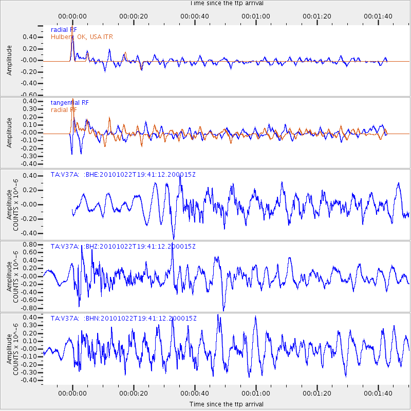
V37A Hulbert, OK, USA - Earthquake Result Viewer
*The percent match for this event was below the threshold and hence no stack was calculated.
| Earthquake location: |
Chile-Bolivia Border Region |
| Earthquake latitude/longitude: |
-20.9/-68.4 |
| Earthquake time(UTC): |
2010/10/22 (295) 19:31:37 GMT |
| Earthquake Depth: |
132 km |
| Earthquake Magnitude: |
5.8 MW, 5.4 MB, 5.8 MW |
| Earthquake Catalog/Contributor: |
WHDF/NEIC |
|
| Network: |
TA USArray Transportable Network (new EarthScope stations) |
| Station: |
V37A Hulbert, OK, USA |
| Lat/Lon: |
35.88 N/95.14 W |
| Elevation: |
219 m |
|
| Distance: |
61.9 deg |
| Az: |
335.5 deg |
| Baz: |
151.476 deg |
| Ray Param: |
$rayparam |
*The percent match for this event was below the threshold and hence was not used in the summary stack. |
|
| Radial Match: |
50.773132 % |
| Radial Bump: |
400 |
| Transverse Match: |
68.6256 % |
| Transverse Bump: |
400 |
| SOD ConfigId: |
339645 |
| Insert Time: |
2011-02-24 07:55:28.345 +0000 |
| GWidth: |
2.5 |
| Max Bumps: |
400 |
| Tol: |
0.001 |
|
Signal To Noise
| Channel | StoN | STA | LTA |
| TA:V37A: :BHZ:20101022T19:41:12.200015Z | 2.731042 | 3.4648602E-7 | 1.2686954E-7 |
| TA:V37A: :BHN:20101022T19:41:12.200015Z | 1.4215387 | 1.5140121E-7 | 1.0650516E-7 |
| TA:V37A: :BHE:20101022T19:41:12.200015Z | 2.3022113 | 2.3124196E-7 | 1.00443415E-7 |
| Arrivals |
| Ps | |
| PpPs | |
| PsPs/PpSs | |


