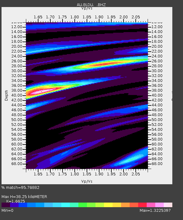
BLDU Ballidu, Western Australia - Earthquake Result Viewer

Earthquake location: Southern Sumatra, Indonesia
Earthquake latitude/longitude: -3.5/100.1
Earthquake time(UTC): 2010/10/25 (298) 14:42:22 GMT
Earthquake Depth: 20 km
Earthquake Magnitude: 6.5 MB, 7.3 MS, 7.8 MW, 7.7 MW
Earthquake Catalog/Contributor: WHDF/NEIC
Network: AU Australian Seismological Centre
Station: BLDU Ballidu, Western Australia
Lat/Lon: 30.61 S/116.71 E
Elevation: 280 m
Distance: 31.2 deg
Az: 151.582 deg
Baz: 326.564 deg
Ray Param: 0.07911363
Estimated Moho Depth: 38.25 km
Estimated Crust Vp/Vs: 1.66
Assumed Crust Vp: 6.419 km/s
Estimated Crust Vs: 3.861 km/s
Estimated Crust Poisson's Ratio: 0.22
Radial Match: 95.76882 %
Radial Bump: 224
Transverse Match: 85.60681 %
Transverse Bump: 400
SOD ConfigId: 339645
Insert Time: 2011-02-24 08:24:08.585 +0000
GWidth: 2.5
Max Bumps: 400
Tol: 0.001

Signal To Noise

ChannelStoNSTALTA
AU:BLDU: :BHZ:20101025T14:48:09.870004Z2.3534235.627427E-72.3911667E-7
AU:BLDU: :BHN:20101025T14:48:09.870004Z0.717734752.2184496E-73.0909047E-7
AU:BLDU: :BHE:20101025T14:48:09.870004Z1.37283642.7868842E-72.0300193E-7
Arrivals
Ps4.3 SECOND
PpPs15 SECOND
PsPs/PpSs19 SECOND