
SNAA GEOFON/AWI Station Sanae, Antarctica - Earthquake Result Viewer
| ||||||||||||||||||
| ||||||||||||||||||
| ||||||||||||||||||
|
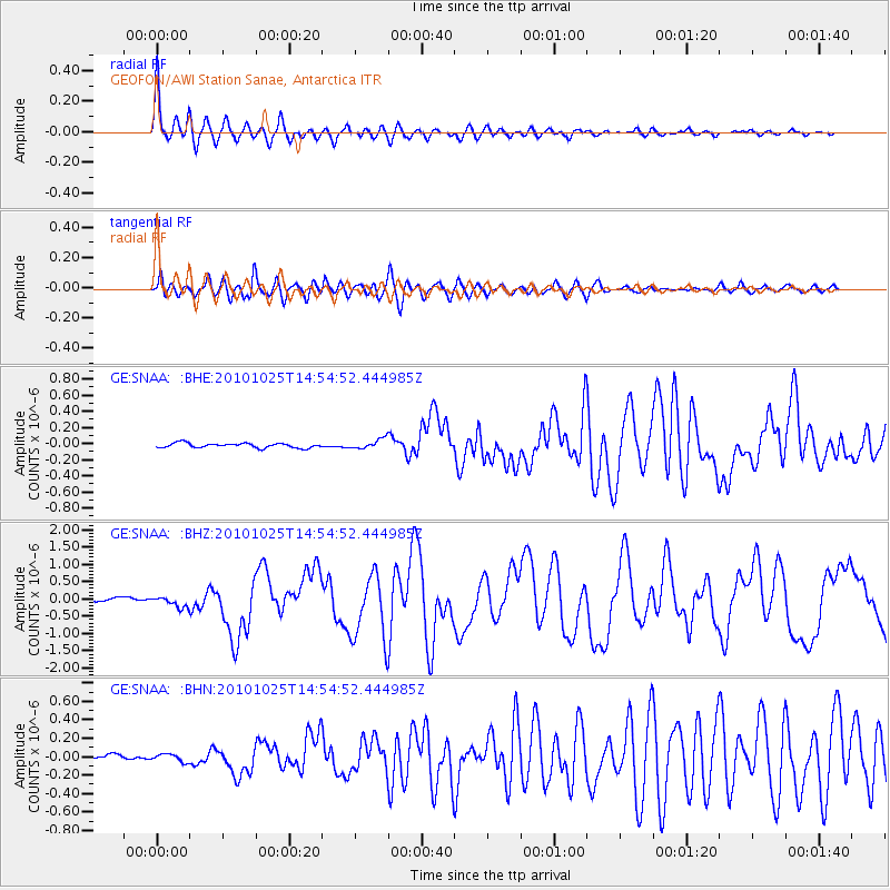
Signal To Noise
| Channel | StoN | STA | LTA |
| GE:SNAA: :BHZ:20101025T14:54:52.444985Z | 3.4028845 | 1.5032782E-7 | 4.4176584E-8 |
| GE:SNAA: :BHN:20101025T14:54:52.444985Z | 1.5048137 | 4.052552E-8 | 2.693059E-8 |
| GE:SNAA: :BHE:20101025T14:54:52.444985Z | 2.1652045 | 6.253536E-8 | 2.888196E-8 |
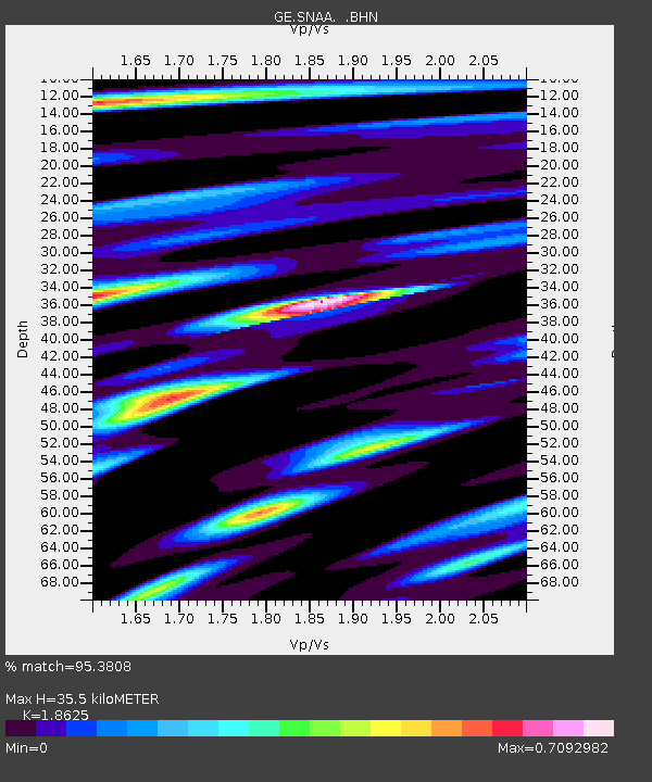
| Arrivals | |
| Ps | 4.9 SECOND |
| PpPs | 15 SECOND |
| PsPs/PpSs | 20 SECOND |

