
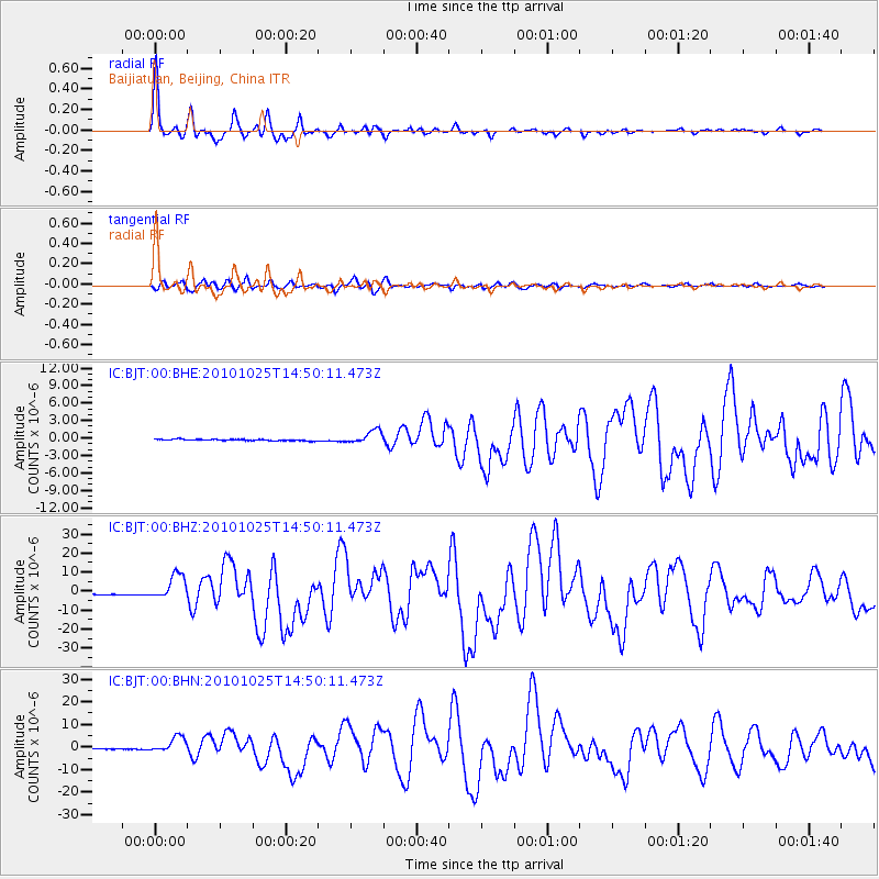
BJT Baijiatuan, Beijing, China - Earthquake Result Viewer
| ||||||||||||||||||
| ||||||||||||||||||
| ||||||||||||||||||
|
Signal To Noise
| Channel | StoN | STA | LTA |
| IC:BJT:00:BHZ:20101025T14:50:11.473Z | 21.915274 | 6.714365E-6 | 3.0637833E-7 |
| IC:BJT:00:BHN:20101025T14:50:11.473Z | 14.267536 | 3.383193E-6 | 2.3712524E-7 |
| IC:BJT:00:BHE:20101025T14:50:11.473Z | 9.099489 | 1.1511793E-6 | 1.2651032E-7 |
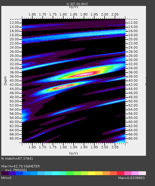
| Arrivals | |
| Ps | 5.6 SECOND |
| PpPs | 17 SECOND |
| PsPs/PpSs | 23 SECOND |

