CASY Casey, Antarctica - Earthquake Result Viewer
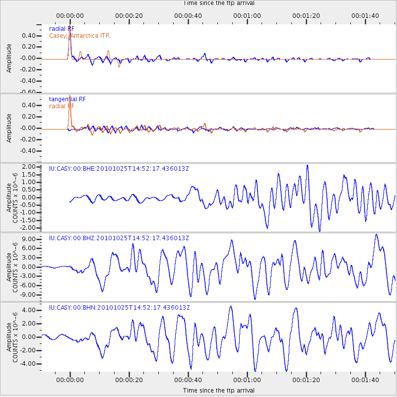
Earthquake location: Southern Sumatra, Indonesia
Earthquake latitude/longitude: -3.5/100.1
Earthquake time(UTC): 2010/10/25 (298) 14:42:22 GMT
Earthquake Depth: 20 km
Earthquake Magnitude: 6.5 MB, 7.3 MS, 7.8 MW, 7.7 MW
Earthquake Catalog/Contributor: WHDF/NEIC
Network: IU Global Seismograph Network (GSN - IRIS/USGS)
Station: CASY Casey, Antarctica
Lat/Lon: 66.28 S/110.54 E
Elevation: 10 m
Distance: 63.1 deg
Az: 175.279 deg
Baz: 348.284 deg
Ray Param: 0.059770864
Estimated Moho Depth: 16.0 km
Estimated Crust Vp/Vs: 1.61
Assumed Crust Vp: 6.356 km/s
Estimated Crust Vs: 3.96 km/s
Estimated Crust Poisson's Ratio: 0.18
Radial Match: 95.04894 %
Radial Bump: 225
Transverse Match: 81.77365 %
Transverse Bump: 400
SOD ConfigId: 339645
Insert Time: 2011-02-24 08:26:58.806 +0000
GWidth: 2.5
Max Bumps: 400
Tol: 0.001

Signal To Noise

ChannelStoNSTALTA
IU:CASY:00:BHZ:20101025T14:52:17.436013Z3.5392569.860101E-72.7859247E-7
IU:CASY:00:BHN:20101025T14:52:17.436013Z1.43940753.4220812E-72.3774237E-7
IU:CASY:00:BHE:20101025T14:52:17.436013Z1.0224011.5272393E-71.4937773E-7
Arrivals
Ps1.6 SECOND
PpPs6.3 SECOND
PsPs/PpSs7.9 SECOND