USP KN.USP - Earthquake Result Viewer
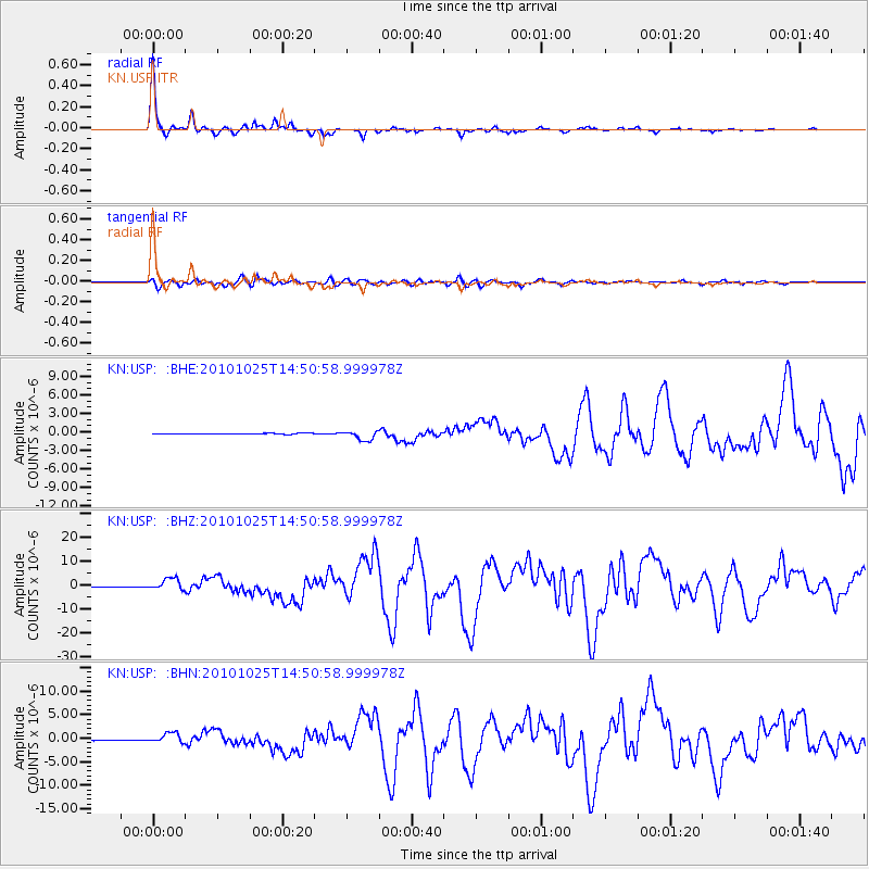
Earthquake location: Southern Sumatra, Indonesia
Earthquake latitude/longitude: -3.5/100.1
Earthquake time(UTC): 2010/10/25 (298) 14:42:22 GMT
Earthquake Depth: 20 km
Earthquake Magnitude: 6.5 MB, 7.3 MS, 7.8 MW, 7.7 MW
Earthquake Catalog/Contributor: WHDF/NEIC
Network: KN Kyrgyz Seismic Telemetry Network
Station: USP KN.USP
Lat/Lon: 43.27 N/74.50 E
Elevation: 740 m
Distance: 51.9 deg
Az: 336.387 deg
Baz: 146.814 deg
Ray Param: 0.06705231
Estimated Moho Depth: 44.75 km
Estimated Crust Vp/Vs: 1.80
Assumed Crust Vp: 6.306 km/s
Estimated Crust Vs: 3.513 km/s
Estimated Crust Poisson's Ratio: 0.27
Radial Match: 99.101 %
Radial Bump: 213
Transverse Match: 93.27654 %
Transverse Bump: 400
SOD ConfigId: 339645
Insert Time: 2011-02-24 08:27:19.444 +0000
GWidth: 2.5
Max Bumps: 400
Tol: 0.001

Signal To Noise

ChannelStoNSTALTA
KN:USP: :BHZ:20101025T14:50:58.999978Z33.146412.5727572E-67.7617976E-8
KN:USP: :BHN:20101025T14:50:58.999978Z15.4504941.1221719E-67.2630165E-8
KN:USP: :BHE:20101025T14:50:58.999978Z10.5761267.985958E-77.550929E-8
Arrivals
Ps5.9 SECOND
PpPs19 SECOND
PsPs/PpSs25 SECOND