You are here: Home > Network List > IU - Global Seismograph Network (GSN - IRIS/USGS) Stations List
> Station CTAO Charters Towers, Australia > Earthquake Result Viewer
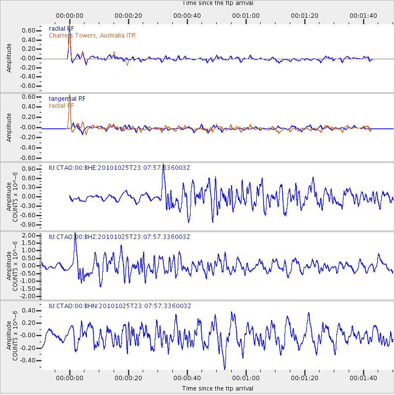
CTAO Charters Towers, Australia - Earthquake Result Viewer
*The percent match for this event was below the threshold and hence no stack was calculated.
| Earthquake location: |
Southern Sumatra, Indonesia |
| Earthquake latitude/longitude: |
-3.3/100.5 |
| Earthquake time(UTC): |
2010/10/25 (298) 22:59:53 GMT |
| Earthquake Depth: |
19 km |
| Earthquake Magnitude: |
5.8 MB, 5.9 MS, 5.9 MW, 5.8 MW |
| Earthquake Catalog/Contributor: |
WHDF/NEIC |
|
| Network: |
IU Global Seismograph Network (GSN - IRIS/USGS) |
| Station: |
CTAO Charters Towers, Australia |
| Lat/Lon: |
20.09 S/146.25 E |
| Elevation: |
357 m |
|
| Distance: |
47.6 deg |
| Az: |
114.243 deg |
| Baz: |
284.414 deg |
| Ray Param: |
$rayparam |
*The percent match for this event was below the threshold and hence was not used in the summary stack. |
|
| Radial Match: |
75.0892 % |
| Radial Bump: |
400 |
| Transverse Match: |
72.11263 % |
| Transverse Bump: |
400 |
| SOD ConfigId: |
339645 |
| Insert Time: |
2011-02-24 08:40:13.756 +0000 |
| GWidth: |
2.5 |
| Max Bumps: |
400 |
| Tol: |
0.001 |
|
Signal To Noise
| Channel | StoN | STA | LTA |
| IU:CTAO:00:BHZ:20101025T23:07:57.336003Z | 5.7885585 | 8.0594725E-7 | 1.3923108E-7 |
| IU:CTAO:00:BHN:20101025T23:07:57.336003Z | 2.0653634 | 1.4210609E-7 | 6.8804404E-8 |
| IU:CTAO:00:BHE:20101025T23:07:57.336003Z | 4.239181 | 3.7965432E-7 | 8.955841E-8 |
| Arrivals |
| Ps | |
| PpPs | |
| PsPs/PpSs | |


