You are here: Home > Network List > US - United States National Seismic Network Stations List
> Station LONY Lake Ozonia, New York, USA > Earthquake Result Viewer
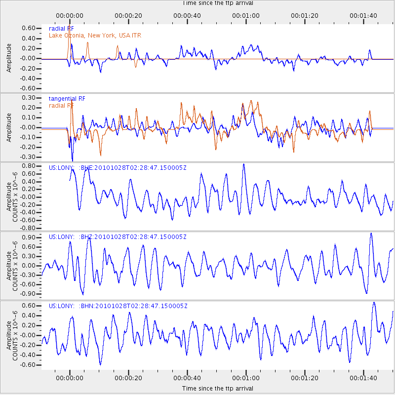
LONY Lake Ozonia, New York, USA - Earthquake Result Viewer
*The percent match for this event was below the threshold and hence no stack was calculated.
| Earthquake location: |
Gulf Of California |
| Earthquake latitude/longitude: |
23.1/-108.5 |
| Earthquake time(UTC): |
2010/10/28 (301) 02:22:25 GMT |
| Earthquake Depth: |
10 km |
| Earthquake Magnitude: |
5.6 MW, 5.2 MS, 5.3 MB, 5.4 MW |
| Earthquake Catalog/Contributor: |
WHDF/NEIC |
|
| Network: |
US United States National Seismic Network |
| Station: |
LONY Lake Ozonia, New York, USA |
| Lat/Lon: |
44.62 N/74.58 W |
| Elevation: |
440 m |
|
| Distance: |
35.0 deg |
| Az: |
43.91 deg |
| Baz: |
243.417 deg |
| Ray Param: |
$rayparam |
*The percent match for this event was below the threshold and hence was not used in the summary stack. |
|
| Radial Match: |
45.748207 % |
| Radial Bump: |
400 |
| Transverse Match: |
53.202374 % |
| Transverse Bump: |
400 |
| SOD ConfigId: |
339645 |
| Insert Time: |
2011-02-24 08:50:28.178 +0000 |
| GWidth: |
2.5 |
| Max Bumps: |
400 |
| Tol: |
0.001 |
|
Signal To Noise
| Channel | StoN | STA | LTA |
| US:LONY: :BHZ:20101028T02:28:47.150005Z | 1.8049474 | 5.0899894E-7 | 2.820021E-7 |
| US:LONY: :BHN:20101028T02:28:47.150005Z | 1.3253796 | 2.6703725E-7 | 2.0147982E-7 |
| US:LONY: :BHE:20101028T02:28:47.150005Z | 1.0358301 | 3.4425034E-7 | 3.3234247E-7 |
| Arrivals |
| Ps | |
| PpPs | |
| PsPs/PpSs | |


