You are here: Home > Network List > CI - Caltech Regional Seismic Network Stations List
> Station SWS Sam W. Stewart, Westmorland, CA, USA > Earthquake Result Viewer
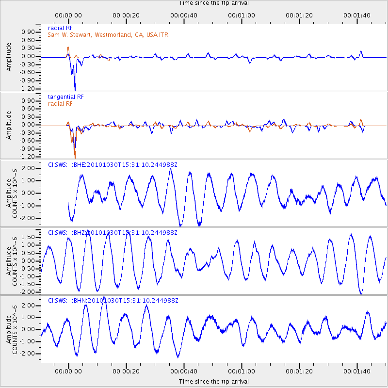
SWS Sam W. Stewart, Westmorland, CA, USA - Earthquake Result Viewer
*The percent match for this event was below the threshold and hence no stack was calculated.
| Earthquake location: |
Pacific-Antarctic Ridge |
| Earthquake latitude/longitude: |
-56.6/-142.3 |
| Earthquake time(UTC): |
2010/10/30 (303) 15:18:33 GMT |
| Earthquake Depth: |
10 km |
| Earthquake Magnitude: |
5.5 MB, 6.1 MS, 6.4 MW, 6.3 MW |
| Earthquake Catalog/Contributor: |
WHDF/NEIC |
|
| Network: |
CI Caltech Regional Seismic Network |
| Station: |
SWS Sam W. Stewart, Westmorland, CA, USA |
| Lat/Lon: |
32.94 N/115.80 W |
| Elevation: |
140 m |
|
| Distance: |
92.0 deg |
| Az: |
22.048 deg |
| Baz: |
194.299 deg |
| Ray Param: |
$rayparam |
*The percent match for this event was below the threshold and hence was not used in the summary stack. |
|
| Radial Match: |
85.75431 % |
| Radial Bump: |
400 |
| Transverse Match: |
70.90209 % |
| Transverse Bump: |
400 |
| SOD ConfigId: |
343573 |
| Insert Time: |
2011-03-03 07:36:23.736 +0000 |
| GWidth: |
2.5 |
| Max Bumps: |
400 |
| Tol: |
0.001 |
|
Signal To Noise
| Channel | StoN | STA | LTA |
| CI:SWS: :BHZ:20101030T15:31:10.244988Z | 1.9017905 | 1.2516384E-6 | 6.5813686E-7 |
| CI:SWS: :BHN:20101030T15:31:10.244988Z | 2.0995412 | 1.1773006E-6 | 5.6074185E-7 |
| CI:SWS: :BHE:20101030T15:31:10.244988Z | 1.1277679 | 9.959427E-7 | 8.831097E-7 |
| Arrivals |
| Ps | |
| PpPs | |
| PsPs/PpSs | |


