You are here: Home > Network List > TA - USArray Transportable Network (new EarthScope stations) Stations List
> Station X33A Lawton, OK, USA > Earthquake Result Viewer
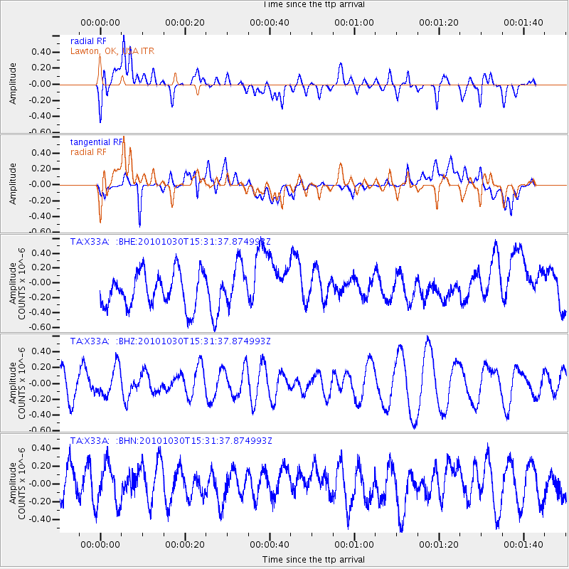
X33A Lawton, OK, USA - Earthquake Result Viewer
*The percent match for this event was below the threshold and hence no stack was calculated.
| Earthquake location: |
Pacific-Antarctic Ridge |
| Earthquake latitude/longitude: |
-56.6/-142.3 |
| Earthquake time(UTC): |
2010/10/30 (303) 15:18:33 GMT |
| Earthquake Depth: |
10 km |
| Earthquake Magnitude: |
5.5 MB, 6.1 MS, 6.4 MW, 6.3 MW |
| Earthquake Catalog/Contributor: |
WHDF/NEIC |
|
| Network: |
TA USArray Transportable Network (new EarthScope stations) |
| Station: |
X33A Lawton, OK, USA |
| Lat/Lon: |
34.54 N/98.50 W |
| Elevation: |
346 m |
|
| Distance: |
98.1 deg |
| Az: |
35.239 deg |
| Baz: |
202.75 deg |
| Ray Param: |
$rayparam |
*The percent match for this event was below the threshold and hence was not used in the summary stack. |
|
| Radial Match: |
54.197735 % |
| Radial Bump: |
400 |
| Transverse Match: |
44.631157 % |
| Transverse Bump: |
400 |
| SOD ConfigId: |
343573 |
| Insert Time: |
2011-03-03 07:38:10.068 +0000 |
| GWidth: |
2.5 |
| Max Bumps: |
400 |
| Tol: |
0.001 |
|
Signal To Noise
| Channel | StoN | STA | LTA |
| TA:X33A: :BHZ:20101030T15:31:37.874993Z | 1.2184417 | 1.8950361E-7 | 1.5552948E-7 |
| TA:X33A: :BHN:20101030T15:31:37.874993Z | 1.0834373 | 2.3222633E-7 | 2.1434218E-7 |
| TA:X33A: :BHE:20101030T15:31:37.874993Z | 1.2205853 | 2.7787834E-7 | 2.2765991E-7 |
| Arrivals |
| Ps | |
| PpPs | |
| PsPs/PpSs | |


