You are here: Home > Network List > TA - USArray Transportable Network (new EarthScope stations) Stations List
> Station Z35A Perchaven, Sanger, TX, USA > Earthquake Result Viewer
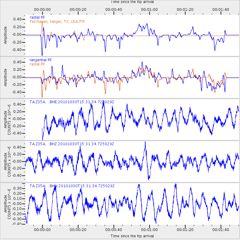
Z35A Perchaven, Sanger, TX, USA - Earthquake Result Viewer
*The percent match for this event was below the threshold and hence no stack was calculated.
| Earthquake location: |
Pacific-Antarctic Ridge |
| Earthquake latitude/longitude: |
-56.6/-142.3 |
| Earthquake time(UTC): |
2010/10/30 (303) 15:18:33 GMT |
| Earthquake Depth: |
10 km |
| Earthquake Magnitude: |
5.5 MB, 6.1 MS, 6.4 MW, 6.3 MW |
| Earthquake Catalog/Contributor: |
WHDF/NEIC |
|
| Network: |
TA USArray Transportable Network (new EarthScope stations) |
| Station: |
Z35A Perchaven, Sanger, TX, USA |
| Lat/Lon: |
33.33 N/97.25 W |
| Elevation: |
235 m |
|
| Distance: |
97.4 deg |
| Az: |
36.679 deg |
| Baz: |
203.25 deg |
| Ray Param: |
$rayparam |
*The percent match for this event was below the threshold and hence was not used in the summary stack. |
|
| Radial Match: |
51.469734 % |
| Radial Bump: |
400 |
| Transverse Match: |
46.913204 % |
| Transverse Bump: |
400 |
| SOD ConfigId: |
343573 |
| Insert Time: |
2011-03-03 07:38:25.221 +0000 |
| GWidth: |
2.5 |
| Max Bumps: |
400 |
| Tol: |
0.001 |
|
Signal To Noise
| Channel | StoN | STA | LTA |
| TA:Z35A: :BHZ:20101030T15:31:34.725029Z | 0.67206514 | 9.390358E-8 | 1.3972392E-7 |
| TA:Z35A: :BHN:20101030T15:31:34.725029Z | 1.4817767 | 1.9198397E-7 | 1.2956336E-7 |
| TA:Z35A: :BHE:20101030T15:31:34.725029Z | 1.4982591 | 2.5428372E-7 | 1.6971946E-7 |
| Arrivals |
| Ps | |
| PpPs | |
| PsPs/PpSs | |


