You are here: Home > Network List > US - United States National Seismic Network Stations List
> Station WMOK Wichita Mountains, Oklahoma, USA > Earthquake Result Viewer
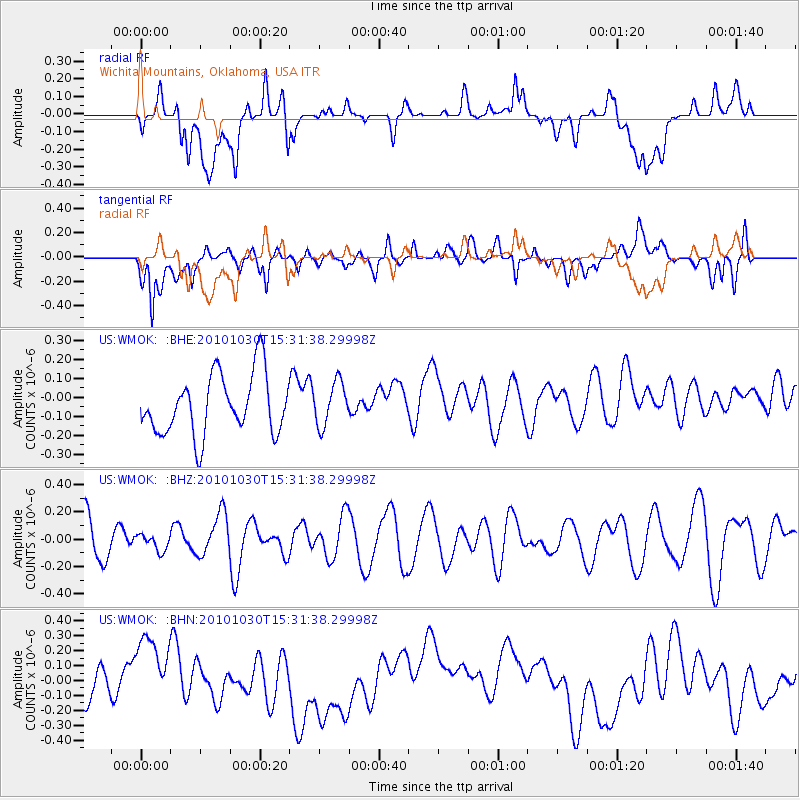
WMOK Wichita Mountains, Oklahoma, USA - Earthquake Result Viewer
*The percent match for this event was below the threshold and hence no stack was calculated.
| Earthquake location: |
Pacific-Antarctic Ridge |
| Earthquake latitude/longitude: |
-56.6/-142.3 |
| Earthquake time(UTC): |
2010/10/30 (303) 15:18:33 GMT |
| Earthquake Depth: |
10 km |
| Earthquake Magnitude: |
5.5 MB, 6.1 MS, 6.4 MW, 6.3 MW |
| Earthquake Catalog/Contributor: |
WHDF/NEIC |
|
| Network: |
US United States National Seismic Network |
| Station: |
WMOK Wichita Mountains, Oklahoma, USA |
| Lat/Lon: |
34.74 N/98.78 W |
| Elevation: |
486 m |
|
| Distance: |
98.2 deg |
| Az: |
34.947 deg |
| Baz: |
202.633 deg |
| Ray Param: |
$rayparam |
*The percent match for this event was below the threshold and hence was not used in the summary stack. |
|
| Radial Match: |
26.900656 % |
| Radial Bump: |
400 |
| Transverse Match: |
64.19966 % |
| Transverse Bump: |
400 |
| SOD ConfigId: |
343573 |
| Insert Time: |
2011-03-03 07:39:02.635 +0000 |
| GWidth: |
2.5 |
| Max Bumps: |
400 |
| Tol: |
0.001 |
|
Signal To Noise
| Channel | StoN | STA | LTA |
| US:WMOK: :BHZ:20101030T15:31:38.29998Z | 0.29374656 | 5.872297E-8 | 1.9991035E-7 |
| US:WMOK: :BHN:20101030T15:31:38.29998Z | 2.4778671 | 2.9635848E-7 | 1.1960225E-7 |
| US:WMOK: :BHE:20101030T15:31:38.29998Z | 0.7246158 | 1.1469531E-7 | 1.5828431E-7 |
| Arrivals |
| Ps | |
| PpPs | |
| PsPs/PpSs | |


