You are here: Home > Network List > KN - Kyrgyz Seismic Telemetry Network Stations List
> Station ULHL KN.ULHL > Earthquake Result Viewer
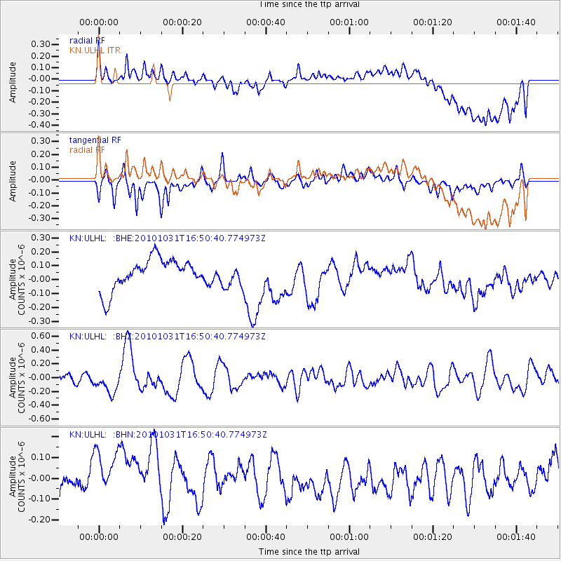
ULHL KN.ULHL - Earthquake Result Viewer
*The percent match for this event was below the threshold and hence no stack was calculated.
| Earthquake location: |
New Britain Region, P.N.G. |
| Earthquake latitude/longitude: |
-6.4/150.2 |
| Earthquake time(UTC): |
2010/10/31 (304) 16:38:49 GMT |
| Earthquake Depth: |
10 km |
| Earthquake Magnitude: |
5.5 MB, 5.5 MS, 5.8 MW, 5.7 MW |
| Earthquake Catalog/Contributor: |
WHDF/NEIC |
|
| Network: |
KN Kyrgyz Seismic Telemetry Network |
| Station: |
ULHL KN.ULHL |
| Lat/Lon: |
42.25 N/76.24 E |
| Elevation: |
2040 m |
|
| Distance: |
82.5 deg |
| Az: |
313.978 deg |
| Baz: |
105.588 deg |
| Ray Param: |
$rayparam |
*The percent match for this event was below the threshold and hence was not used in the summary stack. |
|
| Radial Match: |
52.40497 % |
| Radial Bump: |
400 |
| Transverse Match: |
51.24606 % |
| Transverse Bump: |
400 |
| SOD ConfigId: |
343573 |
| Insert Time: |
2011-03-03 07:42:02.618 +0000 |
| GWidth: |
2.5 |
| Max Bumps: |
400 |
| Tol: |
0.001 |
|
Signal To Noise
| Channel | StoN | STA | LTA |
| KN:ULHL: :BHZ:20101031T16:50:40.774973Z | 2.1270783 | 1.5876498E-7 | 7.463993E-8 |
| KN:ULHL: :BHN:20101031T16:50:40.774973Z | 1.6856403 | 1.6824299E-7 | 9.980954E-8 |
| KN:ULHL: :BHE:20101031T16:50:40.774973Z | 0.8149142 | 8.960945E-8 | 1.0996182E-7 |
| Arrivals |
| Ps | |
| PpPs | |
| PsPs/PpSs | |


