You are here: Home > Network List > CI - Caltech Regional Seismic Network Stations List
> Station MPM Manuel Prospect Mine, California, USA > Earthquake Result Viewer
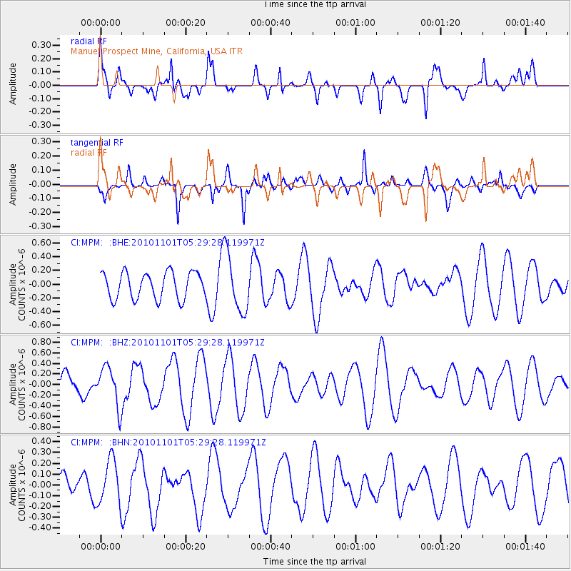
MPM Manuel Prospect Mine, California, USA - Earthquake Result Viewer
*The percent match for this event was below the threshold and hence no stack was calculated.
| Earthquake location: |
New Britain Region, P.N.G. |
| Earthquake latitude/longitude: |
-6.4/150.2 |
| Earthquake time(UTC): |
2010/11/01 (305) 05:16:34 GMT |
| Earthquake Depth: |
8.7 km |
| Earthquake Magnitude: |
5.5 MB, 5.1 MS, 5.5 MW, 5.5 MW |
| Earthquake Catalog/Contributor: |
WHDF/NEIC |
|
| Network: |
CI Caltech Regional Seismic Network |
| Station: |
MPM Manuel Prospect Mine, California, USA |
| Lat/Lon: |
36.06 N/117.49 W |
| Elevation: |
185 m |
|
| Distance: |
95.6 deg |
| Az: |
54.436 deg |
| Baz: |
266.197 deg |
| Ray Param: |
$rayparam |
*The percent match for this event was below the threshold and hence was not used in the summary stack. |
|
| Radial Match: |
54.43209 % |
| Radial Bump: |
400 |
| Transverse Match: |
51.24771 % |
| Transverse Bump: |
384 |
| SOD ConfigId: |
343573 |
| Insert Time: |
2011-03-03 07:45:34.254 +0000 |
| GWidth: |
2.5 |
| Max Bumps: |
400 |
| Tol: |
0.001 |
|
Signal To Noise
| Channel | StoN | STA | LTA |
| CI:MPM: :BHZ:20101101T05:29:28.119971Z | 1.5732262 | 3.8395848E-7 | 2.4405804E-7 |
| CI:MPM: :BHN:20101101T05:29:28.119971Z | 0.9109428 | 2.0768601E-7 | 2.2799018E-7 |
| CI:MPM: :BHE:20101101T05:29:28.119971Z | 2.1952174 | 4.2264506E-7 | 1.9252992E-7 |
| Arrivals |
| Ps | |
| PpPs | |
| PsPs/PpSs | |


