You are here: Home > Network List > AV - Alaska Volcano Observatory Stations List
> Station SPCR Ckakachatna River, Mount Spurr, Alaska > Earthquake Result Viewer
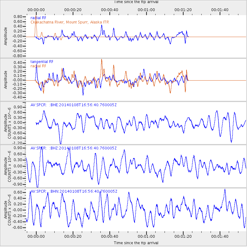
SPCR Ckakachatna River, Mount Spurr, Alaska - Earthquake Result Viewer
*The percent match for this event was below the threshold and hence no stack was calculated.
| Earthquake location: |
Kuril Islands |
| Earthquake latitude/longitude: |
46.5/153.2 |
| Earthquake time(UTC): |
2014/01/08 (008) 16:50:28 GMT |
| Earthquake Depth: |
40 km |
| Earthquake Magnitude: |
5.0 mb |
| Earthquake Catalog/Contributor: |
ISC/ISC |
|
| Network: |
AV Alaska Volcano Observatory |
| Station: |
SPCR Ckakachatna River, Mount Spurr, Alaska |
| Lat/Lon: |
61.20 N/152.21 W |
| Elevation: |
984 m |
|
| Distance: |
34.3 deg |
| Az: |
44.521 deg |
| Baz: |
270.018 deg |
| Ray Param: |
$rayparam |
*The percent match for this event was below the threshold and hence was not used in the summary stack. |
|
| Radial Match: |
59.73968 % |
| Radial Bump: |
400 |
| Transverse Match: |
57.14771 % |
| Transverse Bump: |
331 |
| SOD ConfigId: |
3390531 |
| Insert Time: |
2019-04-09 22:33:51.888 +0000 |
| GWidth: |
2.5 |
| Max Bumps: |
400 |
| Tol: |
0.001 |
|
Signal To Noise
| Channel | StoN | STA | LTA |
| AV:SPCR: :BHZ:20140108T16:56:40.760005Z | 1.9732504 | 6.5087994E-7 | 3.2985164E-7 |
| AV:SPCR: :BHN:20140108T16:56:40.760005Z | 1.032155 | 2.507518E-7 | 2.4294005E-7 |
| AV:SPCR: :BHE:20140108T16:56:40.760005Z | 0.7994833 | 3.0070692E-7 | 3.7612656E-7 |
| Arrivals |
| Ps | |
| PpPs | |
| PsPs/PpSs | |


