You are here: Home > Network List > TA - USArray Transportable Network (new EarthScope stations) Stations List
> Station G35A Watkins, MN, USA > Earthquake Result Viewer
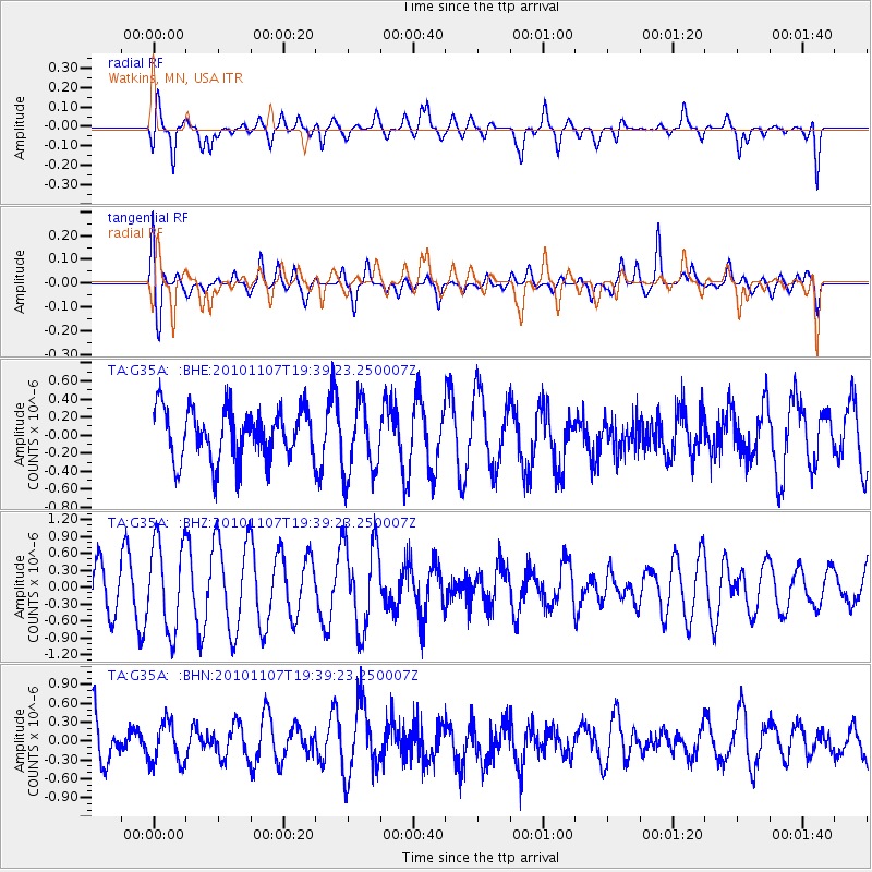
G35A Watkins, MN, USA - Earthquake Result Viewer
*The percent match for this event was below the threshold and hence no stack was calculated.
| Earthquake location: |
Volcano Islands, Japan Region |
| Earthquake latitude/longitude: |
24.4/141.6 |
| Earthquake time(UTC): |
2010/11/07 (311) 19:26:49 GMT |
| Earthquake Depth: |
113 km |
| Earthquake Magnitude: |
5.7 MB, 5.6 MW, 5.6 MW |
| Earthquake Catalog/Contributor: |
WHDF/NEIC |
|
| Network: |
TA USArray Transportable Network (new EarthScope stations) |
| Station: |
G35A Watkins, MN, USA |
| Lat/Lon: |
45.22 N/94.49 W |
| Elevation: |
361 m |
|
| Distance: |
94.0 deg |
| Az: |
36.005 deg |
| Baz: |
310.674 deg |
| Ray Param: |
$rayparam |
*The percent match for this event was below the threshold and hence was not used in the summary stack. |
|
| Radial Match: |
61.9072 % |
| Radial Bump: |
400 |
| Transverse Match: |
54.102684 % |
| Transverse Bump: |
400 |
| SOD ConfigId: |
343573 |
| Insert Time: |
2011-03-05 07:44:47.790 +0000 |
| GWidth: |
2.5 |
| Max Bumps: |
400 |
| Tol: |
0.001 |
|
Signal To Noise
| Channel | StoN | STA | LTA |
| TA:G35A: :BHZ:20101107T19:39:23.250007Z | 1.9792324 | 7.907356E-7 | 3.9951627E-7 |
| TA:G35A: :BHN:20101107T19:39:23.250007Z | 0.81360036 | 3.1884585E-7 | 3.9189493E-7 |
| TA:G35A: :BHE:20101107T19:39:23.250007Z | 1.4349896 | 4.0381502E-7 | 2.8140622E-7 |
| Arrivals |
| Ps | |
| PpPs | |
| PsPs/PpSs | |


