You are here: Home > Network List > TA - USArray Transportable Network (new EarthScope stations) Stations List
> Station C34A RKJ Ranch, Bemidji, MN, USA > Earthquake Result Viewer
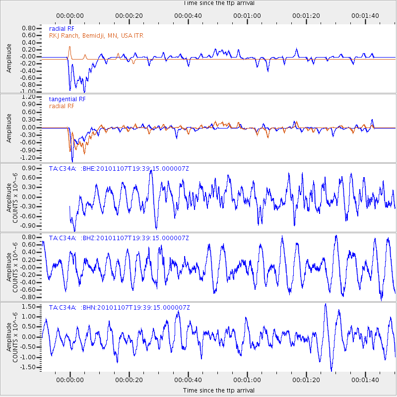
C34A RKJ Ranch, Bemidji, MN, USA - Earthquake Result Viewer
*The percent match for this event was below the threshold and hence no stack was calculated.
| Earthquake location: |
Volcano Islands, Japan Region |
| Earthquake latitude/longitude: |
24.4/141.6 |
| Earthquake time(UTC): |
2010/11/07 (311) 19:26:49 GMT |
| Earthquake Depth: |
113 km |
| Earthquake Magnitude: |
5.7 MB, 5.6 MW, 5.6 MW |
| Earthquake Catalog/Contributor: |
WHDF/NEIC |
|
| Network: |
TA USArray Transportable Network (new EarthScope stations) |
| Station: |
C34A RKJ Ranch, Bemidji, MN, USA |
| Lat/Lon: |
47.65 N/94.91 W |
| Elevation: |
441 m |
|
| Distance: |
92.2 deg |
| Az: |
34.347 deg |
| Baz: |
310.456 deg |
| Ray Param: |
$rayparam |
*The percent match for this event was below the threshold and hence was not used in the summary stack. |
|
| Radial Match: |
40.21354 % |
| Radial Bump: |
400 |
| Transverse Match: |
74.65755 % |
| Transverse Bump: |
400 |
| SOD ConfigId: |
343573 |
| Insert Time: |
2011-03-05 07:45:06.863 +0000 |
| GWidth: |
2.5 |
| Max Bumps: |
400 |
| Tol: |
0.001 |
|
Signal To Noise
| Channel | StoN | STA | LTA |
| TA:C34A: :BHZ:20101107T19:39:15.000007Z | 0.64119864 | 2.8073904E-7 | 4.3783476E-7 |
| TA:C34A: :BHN:20101107T19:39:15.000007Z | 0.77232105 | 5.2425736E-7 | 6.7880757E-7 |
| TA:C34A: :BHE:20101107T19:39:15.000007Z | 1.3044422 | 4.4581614E-7 | 3.4176765E-7 |
| Arrivals |
| Ps | |
| PpPs | |
| PsPs/PpSs | |


