You are here: Home > Network List > II - Global Seismograph Network (GSN - IRIS/IDA) Stations List
> Station MBAR Mbarara, Uganda > Earthquake Result Viewer
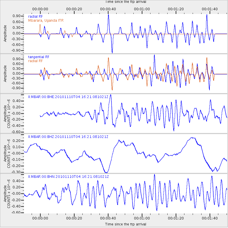
MBAR Mbarara, Uganda - Earthquake Result Viewer
*The percent match for this event was below the threshold and hence no stack was calculated.
| Earthquake location: |
Southeast Indian Ridge |
| Earthquake latitude/longitude: |
-45.5/96.4 |
| Earthquake time(UTC): |
2010/11/10 (314) 04:05:24 GMT |
| Earthquake Depth: |
10 km |
| Earthquake Magnitude: |
6.0 MB, 6.5 MS, 6.5 MW, 6.4 MW |
| Earthquake Catalog/Contributor: |
WHDF/NEIC |
|
| Network: |
II Global Seismograph Network (GSN - IRIS/IDA) |
| Station: |
MBAR Mbarara, Uganda |
| Lat/Lon: |
0.60 S/30.74 E |
| Elevation: |
1390 m |
|
| Distance: |
72.7 deg |
| Az: |
287.4 deg |
| Baz: |
137.811 deg |
| Ray Param: |
$rayparam |
*The percent match for this event was below the threshold and hence was not used in the summary stack. |
|
| Radial Match: |
47.467884 % |
| Radial Bump: |
400 |
| Transverse Match: |
51.580288 % |
| Transverse Bump: |
400 |
| SOD ConfigId: |
343573 |
| Insert Time: |
2011-03-05 07:51:58.357 +0000 |
| GWidth: |
2.5 |
| Max Bumps: |
400 |
| Tol: |
0.001 |
|
Signal To Noise
| Channel | StoN | STA | LTA |
| II:MBAR:00:BHZ:20101110T04:16:21.081021Z | 0.7857608 | 1.1459207E-7 | 1.4583581E-7 |
| II:MBAR:00:BHN:20101110T04:16:21.081021Z | 4.330153 | 1.5177503E-7 | 3.5050732E-8 |
| II:MBAR:00:BHE:20101110T04:16:21.081021Z | 3.3778071 | 1.2384686E-7 | 3.6664872E-8 |
| Arrivals |
| Ps | |
| PpPs | |
| PsPs/PpSs | |


