You are here: Home > Network List > KN - Kyrgyz Seismic Telemetry Network Stations List
> Station CHM KN.CHM > Earthquake Result Viewer
CHM KN.CHM - Earthquake Result Viewer
*The percent match for this event was below the threshold and hence no stack was calculated.
| Earthquake location: |
Southeast Indian Ridge |
| Earthquake latitude/longitude: |
-45.5/96.4 |
| Earthquake time(UTC): |
2010/11/10 (314) 04:05:24 GMT |
| Earthquake Depth: |
10 km |
| Earthquake Magnitude: |
6.0 MB, 6.5 MS, 6.5 MW, 6.4 MW |
| Earthquake Catalog/Contributor: |
WHDF/NEIC |
|
| Network: |
KN Kyrgyz Seismic Telemetry Network |
| Station: |
CHM KN.CHM |
| Lat/Lon: |
43.00 N/74.75 E |
| Elevation: |
655 m |
|
| Distance: |
90.2 deg |
| Az: |
344.301 deg |
| Baz: |
164.956 deg |
| Ray Param: |
$rayparam |
*The percent match for this event was below the threshold and hence was not used in the summary stack. |
|
| Radial Match: |
68.24787 % |
| Radial Bump: |
400 |
| Transverse Match: |
58.968254 % |
| Transverse Bump: |
400 |
| SOD ConfigId: |
343573 |
| Insert Time: |
2011-03-05 07:52:21.264 +0000 |
| GWidth: |
2.5 |
| Max Bumps: |
400 |
| Tol: |
0.001 |
|
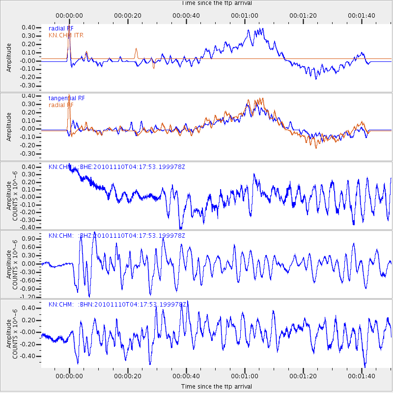
Signal To Noise
| Channel | StoN | STA | LTA |
| KN:CHM: :BHZ:20101110T04:17:53.199978Z | 9.678958 | 5.3818945E-7 | 5.560407E-8 |
| KN:CHM: :BHN:20101110T04:17:53.199978Z | 1.2119298 | 4.7959713E-7 | 3.957301E-7 |
| KN:CHM: :BHE:20101110T04:17:53.199978Z | 1.4524106 | 1.8811828E-7 | 1.2952141E-7 |
| Arrivals |
| Ps | |
| PpPs | |
| PsPs/PpSs | |


