You are here: Home > Network List > KN - Kyrgyz Seismic Telemetry Network Stations List
> Station TKM2 KN.TKM2 > Earthquake Result Viewer
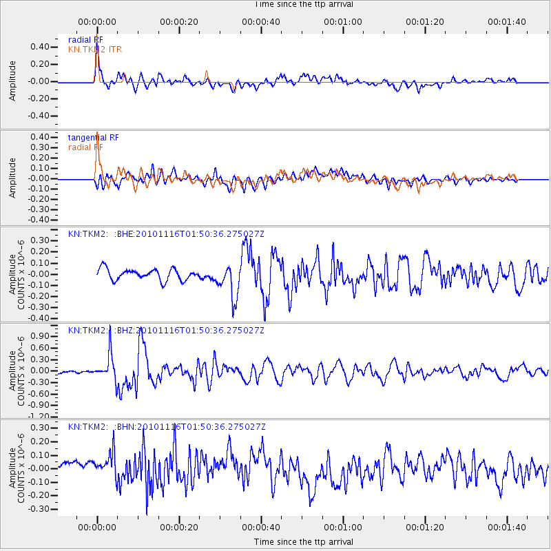
TKM2 KN.TKM2 - Earthquake Result Viewer
*The percent match for this event was below the threshold and hence no stack was calculated.
| Earthquake location: |
Near North Coast Of Irian Jaya |
| Earthquake latitude/longitude: |
-2.0/139.0 |
| Earthquake time(UTC): |
2010/11/16 (320) 01:39:42 GMT |
| Earthquake Depth: |
13 km |
| Earthquake Magnitude: |
5.8 MB, 5.6 MS, 5.9 MW, 5.8 MW |
| Earthquake Catalog/Contributor: |
WHDF/NEIC |
|
| Network: |
KN Kyrgyz Seismic Telemetry Network |
| Station: |
TKM2 KN.TKM2 |
| Lat/Lon: |
42.92 N/75.60 E |
| Elevation: |
2020 m |
|
| Distance: |
72.2 deg |
| Az: |
316.384 deg |
| Baz: |
110.195 deg |
| Ray Param: |
$rayparam |
*The percent match for this event was below the threshold and hence was not used in the summary stack. |
|
| Radial Match: |
72.91247 % |
| Radial Bump: |
400 |
| Transverse Match: |
42.906937 % |
| Transverse Bump: |
400 |
| SOD ConfigId: |
343951 |
| Insert Time: |
2011-05-23 20:12:10.559 +0000 |
| GWidth: |
2.5 |
| Max Bumps: |
400 |
| Tol: |
0.001 |
|
Signal To Noise
| Channel | StoN | STA | LTA |
| KN:TKM2: :BHZ:20101116T01:50:36.275027Z | 10.57269 | 3.6211608E-7 | 3.425014E-8 |
| KN:TKM2: :BHN:20101116T01:50:36.275027Z | 1.2511165 | 1.489301E-7 | 1.1903775E-7 |
| KN:TKM2: :BHE:20101116T01:50:36.275027Z | 3.1479952 | 1.5693278E-7 | 4.9851657E-8 |
| Arrivals |
| Ps | |
| PpPs | |
| PsPs/PpSs | |


