You are here: Home > Network List > UW - Pacific Northwest Regional Seismic Network Stations List
> Station PASS Maple Falls, WA, USA > Earthquake Result Viewer
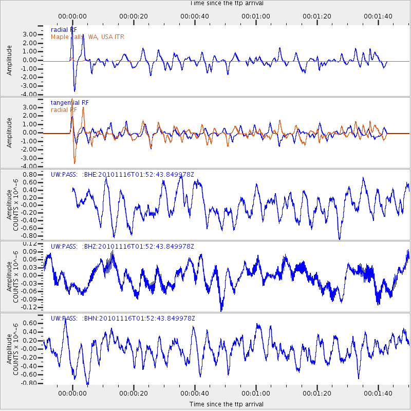
PASS Maple Falls, WA, USA - Earthquake Result Viewer
*The percent match for this event was below the threshold and hence no stack was calculated.
| Earthquake location: |
Near North Coast Of Irian Jaya |
| Earthquake latitude/longitude: |
-2.0/139.0 |
| Earthquake time(UTC): |
2010/11/16 (320) 01:39:42 GMT |
| Earthquake Depth: |
13 km |
| Earthquake Magnitude: |
5.8 MB, 5.6 MS, 5.9 MW, 5.8 MW |
| Earthquake Catalog/Contributor: |
WHDF/NEIC |
|
| Network: |
UW Pacific Northwest Regional Seismic Network |
| Station: |
PASS Maple Falls, WA, USA |
| Lat/Lon: |
49.00 N/122.09 W |
| Elevation: |
174 m |
|
| Distance: |
97.3 deg |
| Az: |
40.999 deg |
| Baz: |
275.416 deg |
| Ray Param: |
$rayparam |
*The percent match for this event was below the threshold and hence was not used in the summary stack. |
|
| Radial Match: |
59.393997 % |
| Radial Bump: |
400 |
| Transverse Match: |
52.218506 % |
| Transverse Bump: |
400 |
| SOD ConfigId: |
343951 |
| Insert Time: |
2011-05-23 20:17:00.202 +0000 |
| GWidth: |
2.5 |
| Max Bumps: |
400 |
| Tol: |
0.001 |
|
Signal To Noise
| Channel | StoN | STA | LTA |
| UW:PASS: :BHZ:20101116T01:52:43.849978Z | 2.3132036 | 8.402909E-8 | 3.6325854E-8 |
| UW:PASS: :BHN:20101116T01:52:43.849978Z | 3.4747021 | 5.192487E-7 | 1.494369E-7 |
| UW:PASS: :BHE:20101116T01:52:43.849978Z | 1.1372933 | 3.9854447E-7 | 3.5043243E-7 |
| Arrivals |
| Ps | |
| PpPs | |
| PsPs/PpSs | |


