You are here: Home > Network List > G - GEOSCOPE Stations List
> Station RER Riviere de l'Est, La Reunion (Indian Ocean) > Earthquake Result Viewer
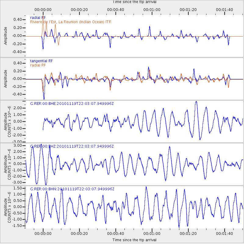
RER Riviere de l'Est, La Reunion (Indian Ocean) - Earthquake Result Viewer
*The percent match for this event was below the threshold and hence no stack was calculated.
| Earthquake location: |
Northern Sumatra, Indonesia |
| Earthquake latitude/longitude: |
1.2/100.1 |
| Earthquake time(UTC): |
2010/11/19 (323) 21:55:15 GMT |
| Earthquake Depth: |
213 km |
| Earthquake Magnitude: |
5.5 MB, 5.7 MW, 5.6 MW |
| Earthquake Catalog/Contributor: |
WHDF/NEIC |
|
| Network: |
G GEOSCOPE |
| Station: |
RER Riviere de l'Est, La Reunion (Indian Ocean) |
| Lat/Lon: |
21.16 S/55.75 E |
| Elevation: |
834 m |
|
| Distance: |
48.7 deg |
| Az: |
240.292 deg |
| Baz: |
68.489 deg |
| Ray Param: |
$rayparam |
*The percent match for this event was below the threshold and hence was not used in the summary stack. |
|
| Radial Match: |
59.541122 % |
| Radial Bump: |
400 |
| Transverse Match: |
69.09742 % |
| Transverse Bump: |
400 |
| SOD ConfigId: |
343951 |
| Insert Time: |
2011-05-23 20:47:36.764 +0000 |
| GWidth: |
2.5 |
| Max Bumps: |
400 |
| Tol: |
0.001 |
|
Signal To Noise
| Channel | StoN | STA | LTA |
| G:RER:00:BHZ:20101119T22:03:07.949996Z | 2.0046616 | 2.1385695E-6 | 1.0667983E-6 |
| G:RER:00:BHN:20101119T22:03:07.949996Z | 1.0814416 | 7.8202515E-7 | 7.2313213E-7 |
| G:RER:00:BHE:20101119T22:03:07.949996Z | 0.8678129 | 4.7413184E-7 | 5.463526E-7 |
| Arrivals |
| Ps | |
| PpPs | |
| PsPs/PpSs | |


